
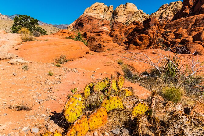
Reviewed · LAS VEGAS
Las Vegas Day Trips: 3-Day Self-Guided Audio Tour
Hoover Dam, red-rock cliffs, and Death Valley’s salt flats make this three-day self-guided tour far more than a drive around Las Vegas. You get GPS-triggered stories, music, directions, and practical tips while you choose the stops that fit your day.
I especially like the one-price-per-car value, useful for families or groups, and the freedom to skip a long hike or linger at a view. The offline map also matters in the desert, where mobile service can be weak. The tradeoff is simple: you drive, navigate the timing, pay for fuel and park costs, and manage the heat yourself.
Key points at a glance
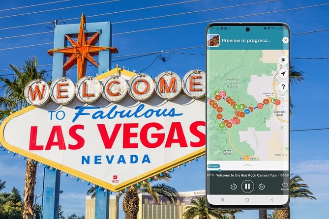
- Three major day trips: Hoover Dam and Lake Mead, Red Rock Canyon, and Death Valley.
- $13.59 for up to 15 people: The cost is per group, not per person.
- Works offline: Download the audio, map, and GPS directions over strong Wi-Fi before leaving.
- Choose your own pace: Start, pause, resume, skip stops, or spread the tours across different days.
- Best for independent drivers: There is no private vehicle, guide, hotel pickup, or fixed departure.
- Plan around desert conditions: Several hikes have no shade, and some back roads need careful checking.
What this Las Vegas audio tour really gives you
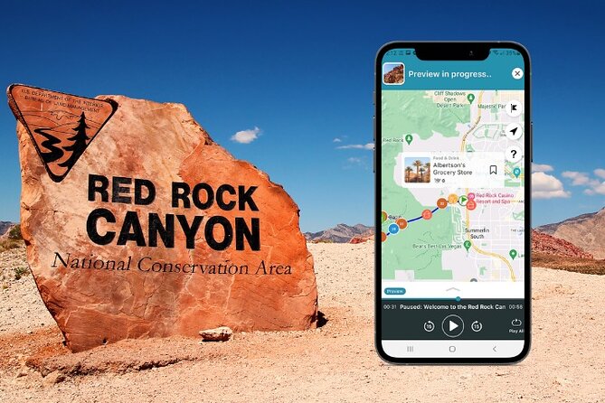
Think of this as three guided road trips stored in the Shaka Guide app. The narration starts automatically as you drive, then adds background stories, directions, music, food suggestions, and ideas for hikes or short photo stops.
You are not joining a bus or following a guide’s clock. Your group stays together in your own vehicle, which makes the experience private and easy to adjust. If you want ten minutes at an overlook, you take ten minutes. If a trail looks too hot, you keep driving.
The tour is offered in English and does not expire. You can use it on the day you planned, pause it for another date, or return to a route later. That flexibility is a major reason the low group price works so well.
The app setup is straightforward. After booking, you receive instructions and a redemption code, then download the tour through the My Stuff tab. Do this on strong Wi-Fi. Once downloaded, the map and GPS work without ongoing Wi-Fi or mobile data.
More Self-Guided Audio Tours in the USA
- Gettysburg Battlefield Self-Guided Driving Audio Tour
★ 4.5 · 910 reviews - Joshua Tree National Park Self-Guided Driving Audio Tour
★ 4.5 · 762 reviews - Ultimate Acadia National Park Self-Guided Driving Audio Tour
★ 4.0 · 521 reviews
Day 1: Hoover Dam, Boulder City, and Lake Mead
The first day combines engineering, desert scenery, wildlife, and a little Las Vegas oddness. The route begins either near Las Vegas Boulevard by Mandalay Bay for the Hoover Dam portion, or at the stated Las Vegas starting point for the wider loop.
Start at the Welcome to Fabulous Las Vegas sign for a quick photo. Ten minutes is enough unless the line is long. This is a brief stop, but it gives the day a proper Las Vegas opening before the road turns toward Boulder City.
In Boulder City, the free Hoover Dam Museum makes a smart first history stop. The town is closely tied to the dam because its construction workers lived here. The museum is open daily from 7 a.m. to 7 p.m., and its displays explain the people and work behind the concrete monument you will see later.
Next, Hemenway Park adds a pleasant change of pace. Green grass is unusual against the desert, and wild bighorn sheep sometimes come down from the mountains. Give yourself a few minutes to scan the slopes instead of assuming the animals will be obvious.
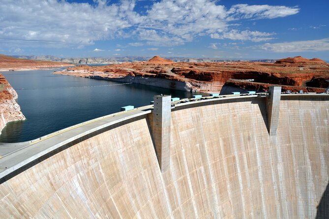
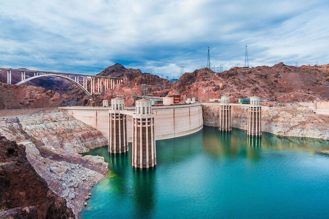
The Hoover Dam Lookout is on the Arizona side and gives you a full view of the dam from a perspective unavailable on the Nevada side. It is a short stop, but the angle helps you understand the size of the structure before you walk around it.
Allow about two hours at Hoover Dam itself. You can walk the grounds without paying an attraction admission, though parking may cost $10, with free parking options also available. Guided dam tours are extra. The dam is both a working piece of infrastructure and a major historical site, so this is one place where the audio context adds real value.
The nearby Mike O’Callaghan-Pat Tillman Memorial Bridge is worth the short walk. Locals often call it the Hoover Dam Bypass bridge. The bridge rises nearly 900 feet above the dam, and panels along the switchback route explain how it was built. Parking and admission are free, but anyone uneasy with heights may prefer to enjoy the view from the approach.
From there, the route opens into Lake Mead National Recreation Area. The Lakeview Overlook gives you a broad view over the marina and water. At the Lake Mead Visitor Center, you can use restrooms, refill water, browse exhibits, and ask park staff for current maps and hiking advice. The listed tour information does not include Lake Mead admission, so budget for park costs separately.
The Historic Railroad Trail is one of the day’s best walks. Old railroad tunnels once carried supplies to Hoover Dam during construction. The full route runs 7.5 miles round trip, but you can walk about two miles round trip to reach the first tunnels and return. It is flat and manageable, yet there is no shade, so avoid the hottest part of the day from May through September. Early morning is the sensible choice.
At Boulder Beach, you can swim, paddleboard, kayak, canoe, sail, collect shells, or simply sit by the shoreline. The beach stop is short in the suggested timing, so treat it as a look at the lake unless you plan to build in extra time.
The drive along Lakeshore Road brings several quick views, including Scenic Overlook and 33 Hole Overlook. The latter reveals canyons carved below the former high-water line. A 2.2-mile hike reaches the canyon, but the opening scramble makes it more demanding than the short distance suggests. Owl Canyon is nearby, and owls sometimes roost in the slot canyon.
Continue along Northshore Road if your schedule allows. Lava-topped and red-rock mountains make this a rewarding scenic drive, even if you only cover part of it.
Back in Las Vegas, the Little White Wedding Chapel offers a quick look at a famous slice of local culture. You can peek inside for free during open hours, and parking is free. Finish at The STRAT, where the observation tower reaches 1,149 feet and offers indoor and outdoor views over the Strip and valley. The listed timing does not include a paid observation ticket, so confirm the current admission cost before treating this as a free stop.
Day 2: Red Rock Canyon’s one-way scenic loop
Red Rock Canyon is the easiest of the three routes to adjust. You can spend a few hours on the loop or make a full day of short walks, picnic stops, and longer hikes.
The Red Rock Canyon Visitor Center comes first because the scenic drive is one-way. It has the area’s running-water restrooms, water filling station, trail information, gift shop, outdoor exhibits, and live desert tortoises. Use the restroom and fill your bottle here before setting off.
A reservation is required for the Scenic Drive during much of the year. Check the current rule before you go. The one-way road contains most of the area’s key sights, so missing your chance to enter the loop can disrupt the whole day.
Calico 1 and Calico Hills offer the first close look at the red formations. You can take photos and leave after a few minutes, but the trail makes a short walk tempting. Depending on your start and end point, the Calico Hills route runs between two and six miles.
At Sandstone Quarry Overlook, look for the old quarry cuts and remaining sandstone slabs. This is also the starting point for Calico Tanks, one of the area’s most popular hikes. Parking can be tight, so patience may be needed. The path is moderate and the views reward a partial walk if you do not have time for the full route.
High Point Overlook and White Rock Trailhead are quick stops with broad views. White Rock sits at the highest point on the scenic drive, 4,771 feet above sea level, and gives you a full turn-around view of the surrounding mountains.
Willow Spring deserves more time. The short Petroglyph Wall Trail reaches ancient rock art in about 0.15 mile, while the Willow Springs Loop runs 1.5 miles round trip. The area also contains an old agave roasting pit. Bighorn sheep may watch from the ledges, though their coloring makes them easy to miss.
At Lost Creek Canyon, the Children’s Discovery Trail includes rocky ground, a boardwalk, desert plants, and a seasonal waterfall that usually flows from December through April. Ice Box Canyon is a good photo and birding stop, but its hike is difficult and better suited to experienced hikers.
The route then reaches several quieter viewpoints. Red Rock Canyon Overlook offers calm mountain views, while Pine Creek Canyon shows open desert and large canyon walls. The Pine Creek trail passes an old homestead site and leads toward a meadow.
Oak Creek Canyon requires a short gravel detour. A regular car can handle the road if you go slowly, but the surface is bumpy. Mule deer sometimes appear near the canyon, and the view is worth the extra turn.
The second Red Rock Canyon Overlook, near a helipad, may be the best viewpoint of the loop. Walk the paved path past Joshua trees to the benches at the end. This is also a strong picnic location.
At Cowboy Up Trail Rides, you can see horses, mules, and possibly Jackson the Red Rock Burro. The Fossil Ridge Trail begins here, and horseback rides may be available with a separate reservation. Finish at Red Spring Picnic Area, where a one-hour break fits nicely with lunch and mountain views.
Day 3: Death Valley from dunes to Dante’s View
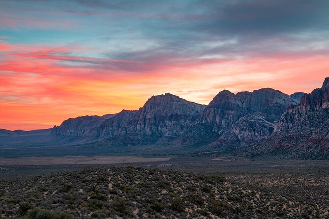
Death Valley is the most ambitious day. The stops cover a large area, so start with a full tank, plenty of water, and realistic expectations about driving time. You do not need to visit every stop. The audio route works best when you choose a few hikes and viewpoints rather than racing through all 19 locations.
The optional Emigrant Canyon Road detour begins with Journigan’s Mill, where foundations, tanks, and other remains mark an early twentieth-century processing plant. At Wildrose Campground, old Civilian Conservation Corps buildings provide another short history stop.
The Charcoal Kilns are the detour’s main reward. Ten beehive-shaped kilns sit high in the Panamint Range, and you can step inside one. Check road conditions before taking this route, since conditions and access can change.
Stovepipe Wells Village is the practical service stop for food, fuel, and a break. Services inside the park are limited, so use this chance before continuing.
At Mesquite Flat Sand Dunes, you can see the dunes from the parking area or walk among the ridges and mesquite trees. This is a strong sunset and stargazing location, but build in more than the suggested 15 minutes if you want to walk out into the sand.
The nearby Devils Cornfield is a small patch of Arrowweed that resembles rows of corn. It is a quick curiosity rather than a major attraction. At Salt Creek Interpretive Trail, an easy half-mile boardwalk crosses wetland habitat and offers a chance to look for the endangered Salt Creek Pupfish.
Harmony Borax Works explains the old mining industry through interpretive signs, machinery remains, and a wagon once pulled by the famous 20-mule teams. Then stop at the Furnace Creek Visitor Center for restrooms, water, maps, and an excellent museum on the park’s natural and human past.
The Ranch at Death Valley is the park’s main place for meals and fuel. Prices are higher, but you will find a buffet-style restaurant, ice cream, a Wild West-themed saloon, a general store, groceries, and the Borax Museum.
South of Furnace Creek, Devil’s Golf Course reveals jagged salt formations along a short dirt road. Wear sturdy shoes if you walk onto the salt. At Badwater Basin, you reach the lowest point in North America. The boardwalk is easy, but the geometric salt formations may be about a mile from the parking area, making the walk roughly two miles round trip.
The Natural Bridge Trail is a rocky, flat mile round trip. Artist’s Drive is a one-way road through a twisting canyon, with Artist’s Palette as the key stop. Mineral colors stain the cliffs, and a short walk lets you see the formations more closely. Check road rules and conditions before driving this route.
Golden Canyon is a favorite hike, with a roughly three-mile round trip to Red Cathedral. If you want a shorter day, simply walk far enough to see the canyon walls before turning around.
At Zabriskie Point, a short but steep paved path leads to one of Death Valley’s signature views. You look over Red Cathedral and Manly Beacon, with a setting familiar from film and album art.
The optional Twenty Mule Team Canyon road is another bumpy dirt detour. It is generally suitable for careful driving in normal conditions, but low-clearance cars should avoid it. Check current conditions first.
Finish at Dante’s View, more than 5,000 feet above Badwater Basin. The overlook gives you the best sense of Death Valley’s scale, with the basin below, the Panamint Range opposite, and, on clear days, the Sierra Nevada and Mount Whitney in the distance. It is also a popular place for sunset and stargazing.
Another self-paced route in the USA:
- Los Angeles: Hop-On Hop-Off Bus Tour with Audio Guide
★ 3.7 · 2,030 reviews - City Sightseeing Hop-On Hop-Off Bus Tour with Audio Guide
★ 3.0 · 1,083 reviews - Medieval Torture Museum Ticket with Audio Guide and Ghost Hunting
★ 5.0 · 962 reviews - San Francisco: Alcatraz, Ferry & Audio Tour w/ Night Option
★ 4.4 · 617 reviews
What the $13.59 price does and does not cover
At $13.59 per group of up to 15, this is unusually inexpensive if you have several people in one car. A group of four pays only a few dollars each, while a solo driver still gets all three routes for one purchase.
You must supply the vehicle, fuel, meals, and refreshments. Parking and attraction or park entrance fees are also separate. Most listed stops are free to enter, but that does not mean every road, park, lot, or paid viewpoint carries no charge.
The value is strongest when you want privacy and flexibility. It is weaker if you prefer someone else to drive, arrange timing, handle parking, or provide live commentary.
Who should book this experience?
Book it if you want to combine several major sights without joining a fixed group. Families, couples, and larger groups will appreciate the per-car pricing, especially because the tour can be paused for meals, rest, or extra hikes.
It also suits independent visitors who like choosing their own level of activity. You can make Red Rock Canyon a gentle scenic drive, walk only the first Hoover Dam railroad tunnels, or spend more time at Death Valley’s major viewpoints.
Skip it if you want hotel pickup, a private driver, or a person beside you answering questions in real time. The app gives you narration and directions, but you remain responsible for navigation, weather choices, road conditions, and timing.
Free cancellation is available up to 24 hours before the scheduled start. Changes or cancellations inside that window are not refundable.
Should you book the Las Vegas self-guided audio tour?
I would book this for a self-drive trip with at least two people in the car, especially if you want Hoover Dam, Red Rock Canyon, and Death Valley in one flexible package. The strongest features are the low group price, offline operation, and freedom to ignore any stop that does not fit your day.
Before booking, make sure you are comfortable with long desert drives and planning around heat. Download everything before leaving, check park reservations and road conditions, carry water, and choose only the hikes you can handle safely. Do that, and this audio tour gives you a practical way to see far more than the Las Vegas Strip.
FAQ
How much does the tour cost?
The tour costs $13.59 per group, with up to 15 people included.
How long does the experience last?
The tour is designed for approximately three days, with one self-guided route for each day. You can also pause and resume the tours on your own schedule.
What destinations are included?
The routes cover Hoover Dam and Lake Mead, Red Rock Canyon National Conservation Area, and Death Valley National Park.
Is transportation included?
No. You need to provide your own vehicle and transportation. Meals, refreshments, parking, and attraction entrance fees are also separate.
Does the audio tour work without mobile data?
Yes. Download the tour, map, and GPS data over strong Wi-Fi first. The audio, map, and GPS directions can then work offline.
Do I have to visit every stop?
No. You can choose the stops that interest you, skip others, and pause or resume the tour whenever you want.
Is a Red Rock Canyon reservation required?
A reservation is required for the Scenic Drive during much of the year. Check the current requirement before starting the Red Rock Canyon route.
What language is the tour offered in?
The tour is offered in English.
Latest audio tours in the USA
- Solvang City Personalized Self-Guided App Tour★ 3.0 · 6 reviews
- Essential Downtown SLO: A Self-Guided Audio Tour★ 4.5 · 27 reviews
- Silicon Valley Self-Guided Driving Audio Tour for Tech Lovers★ 4.0 · 24 reviews
- Self-Guided Audio Tour of the Golden Gate Bridge★ 3.5 · 3 reviews
- The Ghosts of San Francisco Haunted Audio App Walking Tour★ 5.0 · 2 reviews
- Point Reyes National Seashore Self Guided Driving Audio Tour★ 4.0 · 9 reviews
- San Francisco Self-Guided Audio Drive: Explore at Your Own Pace★ 4.0 · 9 reviews
- Explore Coronado Island on a Self Guided Audio Tour★ 5.0 · 2 reviews
Self-Guided Audio Tours, compared.

Acropolis Ticket & Optional Self-Guided Audio Tours
Read our review →

Ultimate Acadia National Park Self-Guided Driving Audio Tour
Read our review →

Akrotiri Ticket with Optional Self-Guided Audios
Read our review →
Browse the lists this tour appears in