
Reviewed · TUCSON
Mount Lemmon Self-Guided Driving Audio Tour
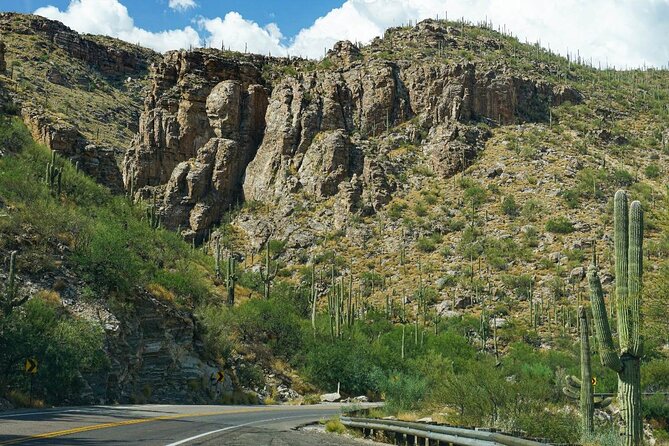
Mount Lemmon’s great trick is its sudden change of climate. In about 30 miles, you climb roughly 6,000 feet, moving from Tucson’s cactus country toward cool pine forest and an alpine summit. This self-guided audio tour gives that dramatic drive a steady narrative, with stories triggered by your location rather than a guide sitting beside you.
I like the excellent value for a carload and the freedom to stop for photos, snacks, hikes, or a picnic without waiting for a group. I also like the mix of ecology, geology, local history, and trail information. The main catch is that the audio follows the uphill route best, so the return drive can confuse the app. Download and test it before leaving town.
Key points about the Mount Lemmon drive
- A 6,000-foot climate change: Watch saguaros give way to grasses, manzanita, aspens, and pines.
- More than 44 audio stories: The route covers scenic overlooks, trailheads, geology, wildlife, and Cold War history.
- Automatic location playback: Stories begin as you reach each point, so you can keep your hands on the wheel.
- $16.99 per group: One purchase covers up to four people in the same car.
- Offline operation: Download the tour on strong Wi-Fi or cellular service before reaching the mountain.
- A flexible route: Start, pause, skip stops, or return another day with lifetime access and no expiry.
Why the Catalina Highway works so well with audio
The Mount Lemmon Scenic Byway is already a fine drive, but a long mountain road can blur into a string of pullouts if you do not know what you are seeing. This tour gives the route a sense of order. It explains why the plants change, points out unusual rock formations, and adds stories to places you might otherwise pass without noticing.
The experience begins at 9070 East Catalina Highway in Tucson and ends near the Mount Lemmon SkyCenter Observatory at 9800 East Ski Run Road. The advertised drive takes about two to three hours, but that is the narration and driving time, not a full day with hikes and long stops. If you plan to walk trails, fish at Rose Canyon Lake, or picnic at Middle Bear, allow much longer.
The app uses GPS to trigger stories. You do not need to tap the screen at every stop. Connect your phone to the car through Bluetooth, USB, or AUX, and let the audio play through the speakers. Apple CarPlay works for audio playback. Android Auto support is still listed as forthcoming, so Android users should plan to use the phone app and car connection directly.
The route is offered in English, and the narrator’s voice is pleasant and easy to follow. The key practical point is speed. Stay within the posted limit and avoid racing ahead of the narration. The timing is designed for a normal uphill drive, and several people found the synchronization impressively precise when they kept pace.
More Self-Guided Audio Tours in the USA
- Gettysburg Battlefield Self-Guided Driving Audio Tour
★ 4.5 · 910 reviews - Joshua Tree National Park Self-Guided Driving Audio Tour
★ 4.5 · 762 reviews - Ultimate Acadia National Park Self-Guided Driving Audio Tour
★ 4.0 · 521 reviews
From Soldier Trail to Babad Do’ag Overlook
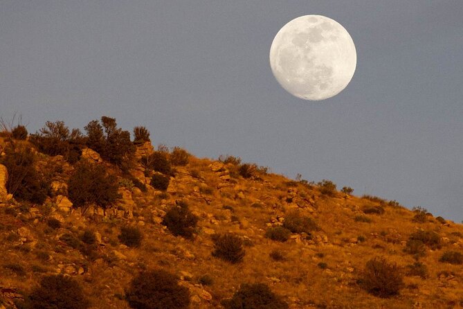
The first part of the drive introduces you to the dry foothills east of Tucson. Soldier Trail offers a challenging five-mile out-and-back hike with saguaros, prickly pear, and about 2,000 feet of gain. It is not a casual warm-up, but the audio helps you see how quickly the mountain begins to rise from the desert.
Soon after comes Babad Do’ag Scenic Overlook, one of the best early stops for a broad view over Tucson and the surrounding mountains. The Babad Do’ag Trail begins here too. It is a moderate 4.5-mile route through saguaros, chollas, and ocotillos.
I would treat these first stops as orientation points rather than trying to hike them all. The city view is the main reward at Babad Do’ag, while Soldier Trail suits you if you want a serious walk before continuing uphill. Pullouts can arrive quickly, so listen for the warning and slow down safely before the viewpoint.
Molino Canyon shows the first ecological shift
At about 4,000 feet, Molino Canyon marks a clear change in plant life. The boulder-filled canyon is surrounded by native grasses, tall ocotillos, desert broom, and pink fairy duster. The audio is especially useful here because it connects the vegetation to altitude and water rather than treating each plant as a separate sight.
Molino Basin Trailhead offers an easier five-mile out-and-back route. The path is relatively flat, making it suitable for trail running or mountain biking, if you have the right equipment. On foot, it takes a little over two hours, so it can fit into a longer day but not a quick roadside break.
Bug Spring Trailhead is more demanding. Its 10-mile out-and-back route begins in dry foothill country, climbs through switchbacks into pine forest, crosses creeks, and ends at Bear Canyon Picnic Area. The gain is about 2,000 feet, with cooler air and thinner atmosphere as you rise. The audio gives you a useful preview, so you can decide early if the walk matches your time and energy.
Thimble Peak, Seven Cataracts, and a good picnic stop
Thimble Peak Vista gives you a clear look at the mountain formation shaped like a giant sewing thimble. The peak rises above 5,000 feet, and the name becomes obvious once you see its outline. This is the sort of small detail that makes an audio route worthwhile. You get a story tied to the exact view in front of you.
Seven Cataracts is a series of waterfalls along Willow Canyon stream. The entire cascade covers about 1,000 vertical feet, but it is not one sheer drop. Water tumbles from rock to rock in a long chain of smaller falls. Conditions can affect how much water you see, so think of this as a geological and scenic stop rather than a guaranteed rushing waterfall.
Middle Bear Picnic Area is one of the more practical stops on the route. Ponderosa pines shelter the picnic tables beside Bear Canyon, with views into the canyon and across to a slope shaped by erosion and landslides. Pack food if you want a proper break. This is also a useful place to pause the tour, stretch, and let the road traffic spread out.
More Driving Audio Tours in the USA
- Ultimate Lake Tahoe Self-Guided Driving Audio Tour
★ 4.5 · 435 reviews - Scenic Newport, RI Self-Guided Driving Audio Tour
★ 4.5 · 325 reviews - Arches National Park Self-Guided Driving Audio Tour
★ 4.5 · 288 reviews - Yellowstone National Park Self-Guided Driving Audio Tour
★ 4.5 · 249 reviews
Manzanita Vista and Windy Point deliver the big views
Manzanita Vista focuses on a plant that looks almost polished. Manzanita has smooth red bark and twisted branches, and it handles poor soil and little water well. The story gives you a reason to stop and look closely instead of simply driving past another stand of shrubs.
Windy Point is one of the strongest viewpoints on the entire route. From here, you can take in the change from the desert floor to the subalpine summit in one wide view. It is the clearest visual summary of the mountain’s biodiversity, and it deserves more than a quick photograph if road conditions and parking allow.
The tour’s 10-minute audio sections at Windy Point and several later stops are a good signal to slow your schedule. You can let the story play, look around, and continue when ready. The app is not a timed group excursion, so you are free to make the stop short or linger.
Hoodoos, Duck Head Rock, and Rose Canyon Lake
Geology Vista Point introduces hoodoos, tall rock spires shaped by erosion in dry, hot climates. Duck Head Rock follows with a more playful formation, a rock shaped like a duck’s head and long bill. These stops add variety to a route that could otherwise feel focused only on plants and elevation.
Hoodoo Vista offers another chance to see these unusual formations. Park in the turnout ahead if you want the view, or keep driving if you already have enough geology for one day. The audio makes it easy to skip a stop without losing the rest of the route.
Rose Canyon Lake changes the mood again. Arizona is not usually the first place you associate with fishing, but this quiet mountain lake offers a peaceful pause away from the busiest viewpoints. Entry rules, passes, or reservations are not included, so check current requirements before planning a fishing stop.
San Pedro Vista looks across the San Pedro Valley and connects the drive to the Arizona National Scenic Trail. The trail runs about 800 miles from the Mexican border to Utah. You do not need to hike it, of course, but the viewpoint helps you understand the scale of Arizona’s mountain and desert corridors.
The upper mountain: Butterfly Trail to Ski Valley
The Palisades Visitor Center is available for a restroom break by turning onto East Organization Ridge Road. That small detail matters on a mountain road, especially if you are traveling with children or planning several hikes.
Butterfly Trail is an 11-mile challenge with a memorable side story. About three miles in, an unofficial path leads to a crashed F86 fighter jet from 1957. The aircraft is not a formal attraction with a standard visit included in this tour, so treat the story as an extra point of interest rather than a guaranteed stop.
Aspen Vista sits at nearly 8,000 feet. On a clear day, you may see about 50 miles to the Galiuro Mountains, with the San Pedro River running through the valley between the ranges. The view gives you a sense of how far the sky-island mountain chains rise above the surrounding desert.
Red Ridge Trail gets its name from its red soil. The color comes from weathered minerals containing iron, essentially rust. The 10-mile route is rated moderate, but the trail length makes it a serious outing. Mt. Lemmon Ski Valley comes next, a reminder that this dry Arizona mountain can support winter sports at its higher elevations.
Cold War history at the SkyCenter
The tour ends beside the Mount Lemmon SkyCenter Observatory, but the final story reaches back to the mountain’s Cold War past. Before it became an observatory, the site held a radar station established in 1956 to watch for enemy aircraft and missiles.
For 10 years, Mount Lemmon operated as the world’s highest continually operating radar station. About 80 men worked there, with many living at the facility full-time because the mountain road made daily commuting impractical. This is one of the tour’s strongest historical details because it connects an otherwise remote summit to a tense period in American history.
The observatory itself is not included as an admission attraction. The audio tour ends nearby, and any entry tickets, reservations, or attraction passes are your responsibility.
Price, setup, and the uphill limitation
At $16.99 for up to four people, the price is low for a private experience. Split among four people, it costs only a few dollars each, and you avoid the fixed schedule of a bus or in-person guide. You also get lifetime access with no expiry, so you can use it on another Mount Lemmon trip or replay sections later.
The setup takes a little care. After booking, look for an email and text containing instructions and a password. Download the separate Action Tour Guide app, enter the password, and download the tour while you have strong Wi-Fi or cellular service. Do not wait until you are high on the mountain, where signal may be unreliable.
The most important limitation is route direction. The narration is built around the uphill drive from Tucson toward Mount Lemmon. On the return trip, the app may not trigger stories in the right order, and one review specifically found downhill use difficult. The byway also functions as a lengthy out-and-back drive rather than a simple route onward to Phoenix from the summit.
If the app points out a pullout just after you pass it, turning around can briefly confuse the GPS sequence. The safest approach is to keep driving, use the next safe turnout, and avoid trying to reverse the route on a narrow mountain road. You can also pause the tour and revisit missed stops later.
Who should book this Mount Lemmon tour?
I would choose this for couples, families, and small groups sharing a rental car. It works especially well if you want context without committing to a live guide, and if different people in your group prefer different amounts of hiking and sightseeing.
It is also a good pick for repeat visits. Lifetime access means you can use the narration once for the main drive, then return for a hike, picnic, fishing stop, or closer look at the geology.
I would skip it if you want a guide physically present, a downhill narration, or a tightly planned hiking tour. The app requires a little preparation, and the route’s timing works best when you follow the intended uphill direction.
FAQ
How much does the Mount Lemmon audio tour cost?
The tour costs $16.99 per group of up to four people. The price is per car group, not per person.
How long does the tour take?
The drive and audio take about two to three hours. Extra time is needed for hiking, picnics, fishing, photographs, and other stops.
Where does the tour begin?
It begins at 9070 East Catalina Highway in Tucson, Arizona.
Where does the tour end?
It ends at 9800 East Ski Run Road near the Mount Lemmon SkyCenter Observatory.
Is the tour guided in person?
No. It is a private, self-guided audio tour. No one meets you at the starting point.
Does the tour work without cell service?
Yes, after you download it. You must download the tour while connected to strong Wi-Fi or cellular service, then it works offline.
What language is available?
The tour is offered in English.
Can I use the tour more than once?
Yes. The tour has lifetime access, does not expire, and can be used on any trip as many times as you want.
What is the cancellation policy?
You can receive a full refund if you cancel at least 24 hours before the experience start time. Cancellations or changes made within 24 hours are not refunded or accepted.
Should you book it?
Book this tour if you want the Mount Lemmon drive to explain itself as you go. The strongest parts are the precise location-triggered stories, the broad mix of science and history, and the freedom to build your own day around the route. At $16.99 for a carload, it is an easy value.
Download it before leaving Tucson, drive uphill at a steady pace, and treat the return trip as a scenic drive rather than a second guided tour. With that small bit of planning, this audio guide turns a beautiful mountain road into a much more understandable and memorable outing.
Latest audio tours in the USA
- Sequoia National Park Self-Guided Audio Tour★ 4.5 · 9 reviews
- Sequoia and Kings Canyon Audio Tour Self Guide National Park Tour★ 5.0 · 3 reviews
- Kings Canyon National Park Self-Guided Audio Tour★ 4.0 · 4 reviews
- Sedona, Arizona Self-Guided Audio Tour★ 4.0 · 36 reviews
- Sedona & Red Rock State Park Self-Guided Driving Audio Tour★ 3.0 · 30 reviews
- Haunted Savannah Self-Guided Walking Audio Tour★ 4.5 · 3 reviews
- Downtown Seattle Self-Guided Walking Audio Tour★ 4.5 · 6 reviews
- Uncover Seattle: Self-Guided Audio Tour★ 3.5 · 7 reviews
Driving Audio Tours, compared.


Ultimate Acadia National Park Self-Guided Driving Audio Tour
Read our review →



Browse the lists this tour appears in