
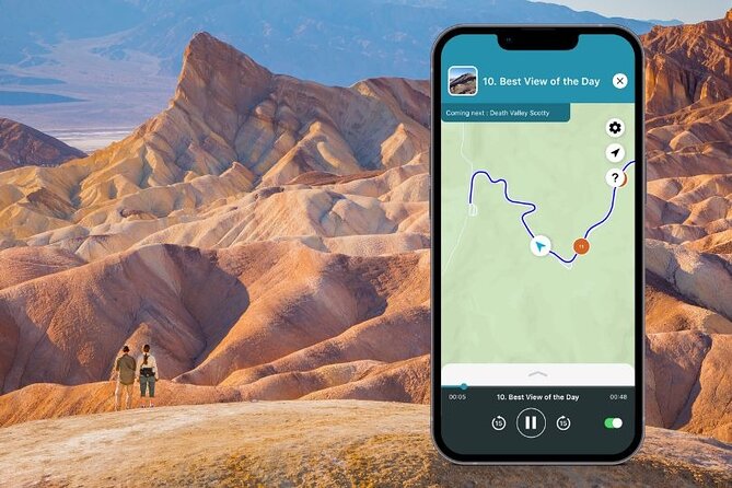
Reviewed · PALM SPRINGS
Death Valley National Park Self-Guided Audio Tour
Death Valley is best explored from behind the wheel, and this self-guided audio tour turns a long, quiet drive into a story-filled route. You’ll follow GPS-triggered narration from Death Valley Junction through salt flats, mining ruins, colorful canyons, and high overlooks, with the freedom to stop for five minutes or stay for an hour.
I like the offline operation, since Death Valley’s cell service can be unreliable, and I like the one-price-per-vehicle setup, which costs $12.79 for a group of up to 15. The main drawback is that the tour does not provide transportation, meals, or the park’s $30-per-vehicle entrance fee, and a full run through the route can take a very long day.
Key things to know before driving
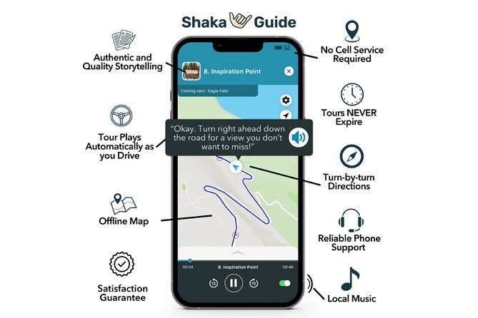
- Badwater Basin is the headline stop: Reach the famous salt flats from the parking area, then walk farther into the basin if conditions allow.
- The app works without service: Download the tour over strong Wi-Fi before you leave, then use GPS-triggered stories and directions offline.
- One purchase covers your vehicle: A group of up to 15 can share the $12.79 tour, making it a strong value for families and small groups.
- You can start in two places: The main starting point is Death Valley Junction, with an optional start near Panamint Springs at the park’s west entrance.
- Several roads need care: Mustard Canyon and Twenty Mule Team Canyon are bumpy dirt roads that are not suitable for low-clearance vehicles.
- The route is flexible, not guided in person: You choose the stops, pace, walking time, and number of days you need.
How this Death Valley audio tour works
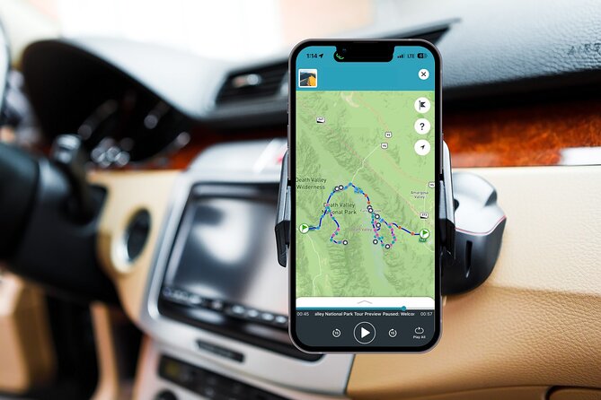
This is a private, self-guided drive using the Shaka Guide app. After booking, you receive a confirmation email with download instructions and a redemption code. Install the app, redeem the tour in the My Stuff tab, and download the route while you have strong Wi-Fi.
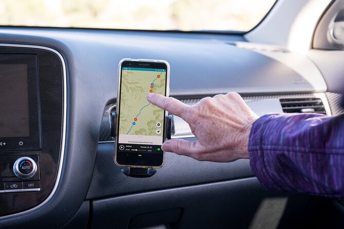
Once you select your starting point, the app uses GPS to play narration, directions, travel tips, and music as you drive. The tour does not need continuous Wi-Fi or mobile data, which matters in Death Valley. Downloading in advance is not just a good idea here. It is part of the preparation.
You can pause and resume the tour, skip stops, or use it over more than one day. That flexibility makes this a better match for independent drivers than for anyone seeking a fixed group departure or a guide riding in the car.
The listed duration is about six to eight hours, but that is best treated as a basic touring day, not a strict timetable. The route includes short viewpoints, walks, optional dirt-road detours, food stops, and longer hikes. If you hike to Red Cathedral, walk well into Badwater Basin, or linger at the dunes, your day will run longer.
More Self-Guided Audio Tours in the USA
- Gettysburg Battlefield Self-Guided Driving Audio Tour
★ 4.5 · 910 reviews - Joshua Tree National Park Self-Guided Driving Audio Tour
★ 4.5 · 762 reviews - Ultimate Acadia National Park Self-Guided Driving Audio Tour
★ 4.0 · 521 reviews
Starting near Death Valley Junction
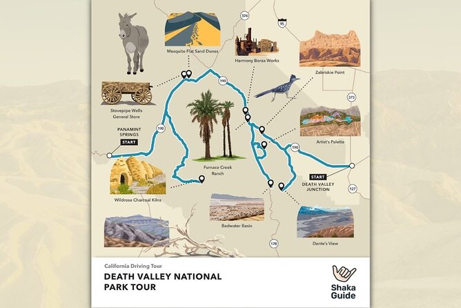
The main starting point is Death Valley Junction, California. The tour can also begin near Panamint Springs at the west entrance, giving you a useful option if you are approaching from that side of the park.
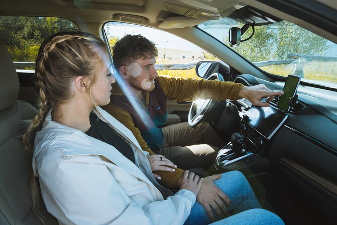
The route information is designed to play automatically as you drive. That means you can keep your eyes on the road rather than repeatedly checking a phone, though you should still pull over safely before studying directions or choosing a stop.
Because this is a driving tour, you need your own private transportation. There is no included vehicle, shuttle, or driver. The tour fee is $12.79 per group of up to 15, so a full carload gets especially good value. You will still need to pay the optional $30 park entrance fee per vehicle, plus your own fuel, food, and any parking charges that apply.
Emigrant Canyon’s mining remains
The first optional section takes you along Emigrant Canyon Road toward the Wildrose Charcoal Kilns. Journigan’s Mill is a brief stop with foundations, empty tanks, and other remains from an early twentieth-century processing plant. There is not much structure left, but photographers and people interested in mining history may enjoy the stark industrial fragments.
Wildrose Campground follows as a quick leg-stretch stop. The site once served as a Civilian Conservation Corps campground, and several remaining buildings sit close to the road. The stop is short, but it breaks up the long drive toward the kilns.
The Charcoal Kilns are the reward for taking this detour. Ten beehive-shaped kilns line up in the Panamint Range at high elevation. You can step inside one, and the charcoal smell may still linger. These unusual structures offer a more tangible look at Death Valley’s working past than a simple roadside viewpoint.
Allow extra time for this section, and check road conditions before setting out. The tour includes the detour, but you do not need to make it the center of your day if your main goal is Badwater Basin and the central valley.
Stovepipe Wells and the Mesquite Flat Sand Dunes
Stovepipe Wells Village is an important practical stop. It offers food, gasoline, visitor services, and accommodation, making it one of the places where you can refresh yourself before continuing. Gas and meals inside the park can cost more, so plan your budget with that in mind.
Mesquite Flat Sand Dunes are the only dunes on this route. You can see them from the parking area, but walking among the sand and mesquite trees gives you a better sense of their size and texture. The tour allows only a short suggested stop, so add time if you want photographs, a longer walk, sunset views, or stargazing.
The nearby Devils Cornfield is a quick curiosity rather than a major attraction. Arrowweed grows in odd clumps that resemble rows of corn. A small parking area lets you stop safely and take a closer look, but you should keep expectations modest. This is a five-minute roadside stop, not a major hike.
More National Park Audio Tours in the USA
- Arches National Park Self-Guided Driving Audio Tour
★ 4.5 · 288 reviews - Yellowstone National Park Self-Guided Driving Audio Tour
★ 4.5 · 249 reviews - Self-Guided GPS Audio E-Bike Tour Hawaii Volcanoes National Park
★ 4.5 · 131 reviews - Shenandoah National Park Self-Guided Driving Audio Tour
★ 4.5 · 109 reviews
Salt Creek and Harmony Borax Works
Salt Creek Interpretive Trail gives you a different side of Death Valley. A half-mile boardwalk crosses a wetland that serves as a watering place for wildlife and habitat for the endangered Salt Creek Pupfish. The easy trail sits down a dirt road, so check conditions and allow a little time to get there.
The stop at Harmony Borax Works adds context to the valley’s mining era. A short interpretive path leads past the remains of buildings and processing equipment, along with one of the wagons associated with the famous twenty-mule teams. This is a useful place to slow down and connect the dry scenery with the labor and machinery that once made borax production possible.
The Furnace Creek Visitor Center is another worthwhile pause. You can get park information, use flush toilets, refill water, and visit a museum covering Death Valley’s natural and human past. The audio tour can point you there, but the center is also a good place to confirm current road conditions before taking the dirt-road detours.
Furnace Creek’s food, fuel, and practical services
The Ranch at Death Valley is the park’s main base for a meal and gasoline. Prices are higher here, but you have several useful choices, including an ice cream parlor, buffet-style restaurant, Wild West-themed saloon, General Store, and small grocery section.
The Borax Museum adds another stop for mining history. You do not need to spend long here if you are trying to reach Badwater before the heat builds, but it can be a sensible place to take a break, refill supplies, and learn more about the area.
This part of the route matters because Death Valley offers long stretches without services. Treat Furnace Creek and Stovepipe Wells as planning points, not just sightseeing stops. Fuel up when you can, carry water, and do not assume the next service area will be close.
Devil’s Golf Course and Badwater Basin
Devil’s Golf Course is one of the strangest stops in the park. Salt has formed rough, jagged shapes across the flat, creating a surface that looks far more severe than an ordinary field. A short dirt road leads from Badwater Road, and there is no formal trail across the formations.
Wear sturdy shoes if you walk out onto the salt. The sharp surface can hurt, and this is not a place for casual sandals. You can also appreciate the view without going far from the parking area.
Badwater Basin is the major stop on the route and the lowest point in North America. A boardwalk begins near the parking area, but the most memorable salt patterns can be about one mile farther into the basin. That makes the walk roughly two miles round trip if you go to the geometric shapes and return.
The distance and heat deserve respect. The tour’s suggested 30-minute stop works for a quick look, but not for a full walk into the basin. Start early or plan the timing carefully, carry water, and be ready to turn around. The salt flats are wide and exposed, with little shade.
Natural Bridge and Artist’s Drive
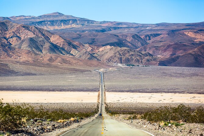
Natural Bridge Trail is about one mile round trip. The route is flat but rocky, leading to a natural bridge formation. It is a manageable walk for many people, but the rocky surface calls for sensible footwear.
Artist’s Drive is one of the most enjoyable driving sections. The one-way road twists upward through a narrow desert canyon, and the drive itself becomes part of the attraction. The key stop is Artist’s Palette, where minerals color the cliffs in shades that contrast with the surrounding rock.
The road is one way, so follow the suggested direction and allow the app’s instructions to guide you. This stop works well for people who want a scenic drive with a short walk, rather than a demanding hike.
Golden Canyon and Zabriskie Point
Golden Canyon Trailhead offers the route’s most substantial hike. The walk to Red Cathedral is about three miles round trip, taking you through a bare, sculpted canyon. The tour suggests about an hour, but your exact time will depend on pace, heat, and how far you go.
If you want to include this hike, build the day around it rather than treating it as a quick roadside stop. Bring water, wear sturdy shoes, and check current conditions before heading out. The audio narration can tell you when the turnoff is coming, but it cannot replace your own judgment about heat and trail conditions.
Zabriskie Point provides one of the park’s most recognizable views. From the short but steep paved walk near the parking area, you look across folded rock formations toward Red Cathedral and Manly Beacon. The overlook also has film history and is associated with the cover of U2’s Joshua Tree.
This is a strong sunrise, late-day, or photography stop, but the short walk is steeper than it first appears. Give yourself time to climb without rushing.
The two dirt-road detours
Mustard Canyon is a small side road with an unusual yellow tint in the canyon walls. There is no formal stop, and the road can be bumpy even when conditions are normal. Check with the park before driving it, especially if you have a low-clearance vehicle.
Twenty Mule Team Canyon offers another short dirt-road adventure, with tight curves and bare, twisting walls. It takes about 15 minutes as a detour from the main route, but road conditions still matter. Neither dirt road should be treated as an automatic add-on.
These detours show why the audio tour’s flexibility is useful. You can skip them if conditions are poor, your vehicle is unsuitable, or you are running short on daylight.
Dante’s View and the best end to the day
Dante’s View climbs more than 5,000 feet above Badwater Basin. From the overlook, you can see the low salt flats below, the Panamint Range across the valley, and, on clear days, the Sierra Nevada with Mount Whitney beyond.
The view gives the whole park a sense of scale that is hard to grasp from valley level. It is also a popular sunset and stargazing location. Allow about 30 minutes, though you may want more if the light is changing or you are watching the valley darken.
Because the route already includes many stops, Dante’s View may be better as a planned finale than a last-minute addition. Check your fuel, daylight, and road conditions before making the climb.
What the $12.79 price really buys you
At $12.79 per group, this is inexpensive if two or more people share a car. A group of 15 pays the same total as a solo driver, so the value improves with every additional passenger. The tour also never expires, allowing you to use it on a later date or spread the route across multiple days.
You are paying for narration, music, GPS directions, an offline map, and the convenience of having the route explain itself as you drive. You are not paying for a guide in the vehicle, transport, food, park admission, or parking.
The audio content is useful for identifying upcoming roads and curves, and it can help you keep track of a large park with many turnoffs. One limitation is that the narration may not continue with as much detail as you want once you reach a site. If you like extended explanations while walking around, bring your own curiosity and use the visitor center museum and interpretive signs as companions.
One practical audio tip is to use the car speakers while driving and switch to headphones while walking. A Shokz headset paired through an AirFly adapter allowed two headsets to play Bluetooth audio at once, which can work well for a private group, though that equipment is not included.
Should you book this Death Valley tour?
Book it if you want an affordable, private way to organize a full Death Valley drive without following a bus schedule. It suits couples, families, and small groups with their own car, especially if you value offline directions, flexible stops, and the ability to pause the tour.
Skip it if you want a live guide, included transportation, or a tightly managed sightseeing schedule. Also think twice about attempting every stop in one day. The strongest plan is to choose your priorities: Badwater Basin and Dante’s View for scale, Artist’s Drive and Zabriskie Point for scenery, or the kilns and Harmony Borax Works for mining history.
Book at least 24 hours before the planned start if you want the option of a full refund. Cancellation within 24 hours is not refundable. Most important, download the tour before entering the park, carry water, check road conditions, and let the heat and daylight set your pace.
FAQ
How much does the Death Valley audio tour cost?
The tour costs $12.79 per group of up to 15 people. The park’s optional $30-per-vehicle entrance fee is not included.
Where does the tour start?
The main starting point is Death Valley Junction, California. An optional starting point is available near Panamint Springs at the park’s west entrance.
How long does the tour take?
The estimated duration is six to eight hours. Longer hikes, extended photo stops, meals, and detours can make the day longer.
Does the tour work without cell service?
Yes. The audio, map, and GPS directions work offline after you download the tour. Use strong Wi-Fi to download it before starting.
Do I need my own vehicle?
Yes. Private transportation is not included, so you need your own car or other vehicle.
Is the tour guided by a person?
No. It is a self-guided audio tour in the Shaka Guide app. Narration, directions, tips, and music play through the app as you drive.
Can I skip stops or use the tour on another day?
Yes. You can pause, resume, skip stops, and use the tour over multiple days. The tour does not expire.
Is the tour available in languages other than English?
The tour is offered in English only.
Latest audio tours in the USA
- Solvang City Personalized Self-Guided App Tour★ 3.0 · 6 reviews
- Essential Downtown SLO: A Self-Guided Audio Tour★ 4.5 · 27 reviews
- Silicon Valley Self-Guided Driving Audio Tour for Tech Lovers★ 4.0 · 24 reviews
- Self-Guided Audio Tour of the Golden Gate Bridge★ 3.5 · 3 reviews
- The Ghosts of San Francisco Haunted Audio App Walking Tour★ 5.0 · 2 reviews
- Point Reyes National Seashore Self Guided Driving Audio Tour★ 4.0 · 9 reviews
- San Francisco Self-Guided Audio Drive: Explore at Your Own Pace★ 4.0 · 9 reviews
- Explore Coronado Island on a Self Guided Audio Tour★ 5.0 · 2 reviews
National Park Audio Tours, compared.

Ultimate Acadia National Park Self-Guided Driving Audio Tour
Read our review →
Vesuvius National Park Skip-The-Line Ticket and Audio Guide
Read our review →
Self-Guided GPS Audio E-Bike Tour Hawaii Volcanoes National Park
Read our review →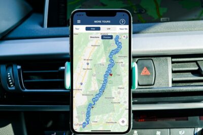
Browse the lists this tour appears in