
Reviewed · USA
Cape Hatteras National Seashore Self-Guided Audio Driving Tour
The most memorable part of this drive is the way the Outer Banks story unfolds from your car window. You hear about hurricanes that opened inlets, sailors lost near the Graveyard of the Atlantic, migratory birds, kitesurfers, Blackbeard, and the old rescue stations that once guarded this dangerous shore. The history follows the road, instead of keeping you inside a museum.
I like two things right away: one purchase covers the whole car, and the location-triggered audio lets you stop, wander, eat, or take photos without losing your place. The offline map is also useful on a long coastal route where phone service may not be dependable. The main drawback is timing. The advertised drive is about two to three hours, but the full route has more than 59 miles and 49 stories, and the supplied timing also allows four to six hours. Treat this as a flexible half-day outing, not a quick spin.
Key points to know before you go
- A 59-mile coastal route: Follow the road from Oregon Inlet toward Hatteras with more than 49 audio stories tied to places along the way.
- A history lesson with variety: Hear about the 1846 hurricane that created Oregon Inlet, the Graveyard of the Atlantic, lighthouse engineering, rescue crews, birds, pirates, and kitesurfing.
- Automatic playback: Stories begin as you reach each location, so you can keep your eyes on the road and your hands on the wheel.
- Good value for a group: The $14.99 price covers up to four people, rather than charging each person separately.
- Lifetime access: Download the tour once and use it on any trip, on any day, with no expiry.
- You control the pace: Stop for Pea Island Beach, museums, views, snacks, and side trips, then resume when ready.
Why this drive works better than a fixed tour
Cape Hatteras National Seashore is spread along a narrow strip of barrier islands. You are not visiting one compact attraction. You are moving through beaches, bridges, wildlife refuge, small communities, historic stations, and lighthouse country.
That geography makes a self-guided audio tour a sensible choice. A bus would impose a schedule, and a standard walking tour could cover only a small part of the coast. Here, the route gives you the broad story while leaving room for your own stops.
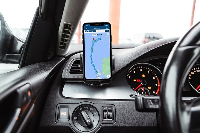
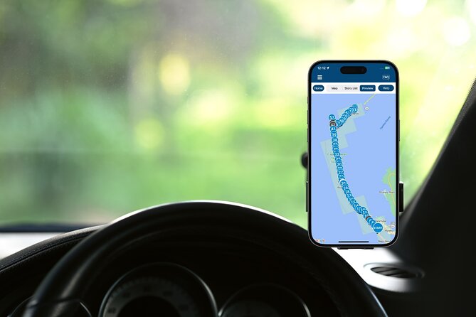
The guide is in English, and the narration plays through Action’s separate tour app. Once you download the route over a strong Wi-Fi or cellular connection, it works offline. The audio begins when you reach the first story point and continues automatically as you approach the next one.
This hands-free design matters. You do not need to keep checking a screen for every turn or story. Connect your phone to the car with Bluetooth, USB, or AUX. Apple CarPlay is supported for audio playback. Android Auto support is listed as forthcoming, so Android users should plan to use the phone or another connection method.
More Self-Guided Audio Tours in the USA
- Gettysburg Battlefield Self-Guided Driving Audio Tour
★ 4.5 · 910 reviews - Joshua Tree National Park Self-Guided Driving Audio Tour
★ 4.5 · 762 reviews - Ultimate Acadia National Park Self-Guided Driving Audio Tour
★ 4.0 · 521 reviews
Starting at Oregon Inlet and the Bonner Bridge
The first major story concerns Oregon Inlet, the waterway linking Pamlico Sound with the Atlantic Ocean. It did not exist before 1846. A powerful hurricane tore open the inlet, changing the coastline and creating the passage you see today.
The tale of the ship Oregon gives the story a little drama. During the storm, the ship was reportedly lifted by rough seas and deposited safely on a sandbar. It is a memorable introduction to a coast shaped by wind, water, and sudden change.
You then approach the Herbert C. Bonner Bridge, built in 1963. The bridge crosses the wide Pamlico Sound, a shallow body of water about 80 miles long and 18 miles wide. Its maximum depth is only about 26 feet.
The audio explains how rivers from the mainland flow into the sound, creating the second largest estuary in the United States after Chesapeake Bay. The shallow water supports commercial fishing, including crabs, oysters, and clams. I like this section because it turns a broad view of water into something useful. You begin to understand that the sound is not just scenery. It is a working part of coastal life.
Allow extra attention here if you enjoy bridges and water views. The road itself needs your focus, so let the audio do the talking while you watch the changing scene.
Rescue stations and the Graveyard of the Atlantic
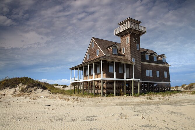
Near the bridge, look for the Oregon Inlet Life-Saving Station, built in 1874. It is especially easy to spot because it is the only structure mentioned at the point where the bridge meets land again.
Before radar, GPS, and sonar, sailors had to navigate shifting sandbars and inlets with far fewer tools. Shipwrecks happened so often that the Outer Banks became known as the Graveyard of the Atlantic.
The life-saving station helps put that nickname in human terms. These were not simply old buildings. They were places where rescue crews lived, watched the coast, practiced, and went out in dangerous conditions. The audio later explains the work of these crews at the Chicamacomico Life-Saving Station as well.
The tour does not include attraction admission, so check any entry fee or opening information separately if you plan to go inside a site. The audio works well even if you only pause outside, but visitors who want a fuller look at rescue history should allow time for the historic station and museum.
Pea Island National Wildlife Refuge and the Atlantic Flyway
The route continues through 13 miles of Pea Island National Wildlife Refuge, stretching from Oregon Inlet to the northern edge of Rodanthe. This is one of the quieter parts of the drive, and the narration gives you a reason to watch the shore and sky.
Pea Island forms part of the Atlantic Flyway, a migration corridor used by birds moving along the coast. The guide compares it to a highway in the sky, with beaches serving as rest stops.
That simple explanation helps you notice the refuge differently. You are not just passing open sand and marsh. You are moving through a place used by birds on a long seasonal journey.
The route also points you toward Pea Island Beach. Parking is available, and the beach is popular, but its size means it may not feel crowded in the way you expect. You do not have to swim. A pause on the sand, with time to take in the sea and shore, fits this tour perfectly.
This is where the flexible format earns its keep. You can pause the narration, spend time at the beach, and restart when you return to the car. The app is designed to pick up where you left off, though you should follow the route and local speed limits for the best results.
More Driving Audio Tours in the USA
- Ultimate Lake Tahoe Self-Guided Driving Audio Tour
★ 4.5 · 435 reviews - Scenic Newport, RI Self-Guided Driving Audio Tour
★ 4.5 · 325 reviews - Arches National Park Self-Guided Driving Audio Tour
★ 4.5 · 288 reviews - Yellowstone National Park Self-Guided Driving Audio Tour
★ 4.5 · 249 reviews
Jughandle Bridge and a road built around nature

The Jughandle Bridge is a good reminder that Outer Banks roads do not always follow a straight line. The audio asks why a bridge is needed when you appear to be driving alongside the island rather than crossing from one island to another.
That question makes the structure more interesting than a routine bridge crossing. The route uses local geography as part of the story, showing how roads and bridges must work around water, sand, and the shape of the barrier islands.
The guide does not turn every stop into a long visit. Many location markers are short, around ten minutes in the supplied schedule. That makes the drive easy to sample. You can listen from the car, stop for a closer look, or skip ahead if a particular subject does not interest you.
Chicamacomico and the old beach apparatus
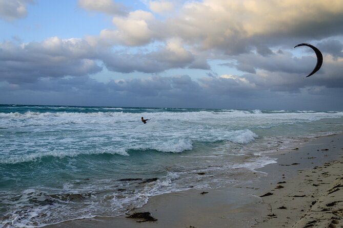
At the Chicamacomico Life-Saving Station Historic Site and Museum, the story returns to coastal rescue. Crews lived at stations like this one, watched the water, and trained to respond when ships ran into trouble.
The unusual feature here is the beach apparatus. The audio asks what this peculiar device was, making it a useful prompt to visit the site or spend a little time learning more about the equipment and methods used before modern rescue technology.
This stop is a good match for anyone who likes practical history. You are not only hearing about famous disasters. You are learning how people worked, trained, and faced danger along an exposed coast.
Keep in mind that the tour price does not cover museum admission. If you want to visit the site rather than simply hear the story from the road, budget extra time and check current opening details before setting out.
Roanoke Island, the Mother Vine, and a change of subject
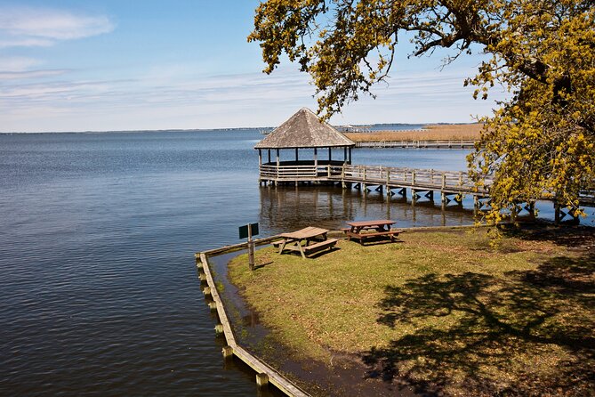
The Mother Vine provides one of the tour’s more unusual stories. Located on Roanoke Island, it is described as the oldest grapevine on the continent still producing grapes, with an estimated age of about 400 years.
This stop broadens the trip beyond shipwrecks and lighthouses. The Outer Banks story includes plants, agriculture, settlement, and local oddities as well as storms and sailors.
Because the route includes Roanoke Island material while ending farther south, pay attention to the app’s starting point and direction. The setup instructions note that you may see more than one tour version, so choose the one that matches your planned start and route. That small step can prevent confusion once you are on the road.
Kite Point and the modern Outer Banks
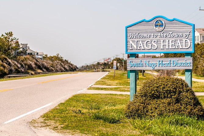
Kite Point brings the story into the present. The spot is a narrow stretch of sandy beach known locally for kitesurfing. Windsurfing became popular on nearby beaches in the 1970s, and the area now offers a place to watch the fast-moving sport.
The audio explains where kitesurfing came from, giving you context for the equipment and activity you may see along the shore. Even if you have no interest in trying the sport, it adds a lively contrast to the older stories about rescue crews and shipwrecks.
This is another stop where the guide helps you notice what is already around you. Instead of seeing only a beach, you get a quick explanation of why this particular stretch attracts the sport.
Cape Hatteras Lighthouse and Blackbeard’s marina
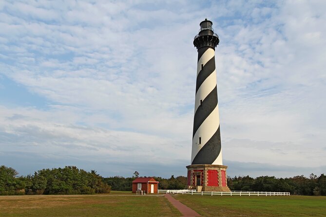
The Cape Hatteras Lighthouse is one of the major sights along the route. The narration connects it with the earlier story of the Bodie Island Lighthouse, which was poorly built and leaned like the Tower of Pisa.
Cape Hatteras Lighthouse had its own difficult beginning, and the story gives you a reason to look closely rather than treating it as just another tall tower. If you plan to visit the lighthouse grounds or another attraction, remember that admission and reservations are not included in the audio tour price.
Near the end, the route reaches Teach’s Lair Marina. The boats on the right are linked to Edward Teach, better known as Blackbeard. His name appears across local landmarks, and the marina provides a final turn toward pirate lore.
The mix is one of the tour’s strengths. You move from geology to fishing, from bird migration to rescue work, then to lighthouses, watersports, and pirates. The topics do not all have equal weight, but the changing subjects help keep a long drive from becoming repetitive.
How long you should allow
The experience is advertised in two ways: roughly two to three hours, and four to six hours for the full 59-mile route with more than 49 stories. The difference makes sense once you separate driving time from touring time.
If you remain in the car and keep moving, you may finish closer to the shorter estimate. If you stop at Pea Island Beach, pause for photos, visit a life-saving station, or make food and sightseeing breaks, the longer estimate is more realistic.
I would plan a half day and avoid booking anything that begins immediately afterward. The app has no fixed time limit, so you can also divide the drive across more than one day. Lifetime access means you can return to the route on another trip or replay stories you skipped.
The service operates daily from 6:00 AM to 9:00 PM during the listed operating period. Start in daylight if you want to see the beaches, bridges, wildlife refuge, and lighthouse clearly.
Price, group size, and practical value
At $14.99 per group of up to four, the price is low for a private driving experience. Four people can share the same purchase, which is usually a better deal than paying individual admission for a guided outing.
You are paying for the narration, route, offline map, and flexible access. You are not paying for lighthouse entry, museum admission, attraction tickets, parking, or reservations. That distinction matters, but it also keeps the base price reasonable.
The tour suits families, couples, and small groups who want structure without a guide in the car. It is also useful if people in your group have different interests. You can skip a story, stop longer at the beach, or take a side trip without holding up anyone else.
The tradeoff is that no person meets you at the start. If the app fails to download, you enter the wrong password, or your phone connection is not ready, you may lose time before the drive begins. Download everything while you have a strong connection, then connect the phone to the car before reaching the first point.
Who should book this audio tour?
You should consider it if you like scenic drives, local history, lighthouses, beaches, and the freedom to set your own schedule. It is especially useful for first-time visitors who want an introduction to the full Cape Hatteras route without joining a bus or fixed group.
Families may appreciate the short stories and the ability to pause. History fans will find plenty about storms, rescue crews, shipwrecks, and Blackbeard. Nature-minded visitors get Pea Island and the Atlantic Flyway, while sport fans get the Kite Point story.
I would skip it if you want a live guide, a deeply detailed museum tour, or a tightly timed excursion with every admission arranged. The narration is designed to guide a drive, not replace every local attraction.
Free cancellation is available when you cancel at least 24 hours before the local start time. Changes or cancellations inside that window are not refunded.
Should you book the Cape Hatteras audio drive?
Book it if you want an inexpensive, flexible way to connect the Outer Banks sights into one clear route. The strongest features are the automatic location-based stories, the offline operation, the no-expiry access, and the chance to share one purchase with up to four people.
Plan for four to six hours if you want to stop properly, and download the app before you arrive. With those expectations, this is a useful companion for Cape Hatteras, giving you enough direction to see more while leaving the coast’s best quality intact: time to stop when something catches your eye.
FAQ
How much does the Cape Hatteras audio driving tour cost?
The tour costs $14.99 per group of up to four people. You purchase access for the car rather than paying separately for each person.
How long is the tour?
The route covers more than 59 miles and includes over 49 audio stories. Driving straight through may take about two to three hours, while stopping at beaches, museums, and viewpoints can extend the outing to four to six hours.
What language is the audio tour offered in?
The tour is offered in English.
Does the tour work without cell service or Wi-Fi?
Yes. You must download the tour while you have a strong Wi-Fi or cellular connection. After that, the offline map and audio can work without an active signal.
How does the audio begin?
Go to the starting point and open Action’s separate audio tour app. The first story begins automatically when you reach its location, and later stories play as you reach the next points.
Where does the tour start and end?
The listed starting point is Cape Hatteras National Park Road in Nags Head, North Carolina. The listed endpoint is 59200 Museum Drive in Hatteras, North Carolina.
Are attraction tickets and museum admissions included?
No. Attraction passes, entry tickets, and reservations are not included in the tour price.
Can I pause the tour or use it on another day?
Yes. You can pause the route, take breaks, explore side trips, and resume later. The access does not expire, so you can use it on any trip and replay it as often as you want.
Latest audio tours in the USA
- Sequoia National Park Self-Guided Audio Tour★ 4.5 · 9 reviews
- Sequoia and Kings Canyon Audio Tour Self Guide National Park Tour★ 5.0 · 3 reviews
- Kings Canyon National Park Self-Guided Audio Tour★ 4.0 · 4 reviews
- Sedona, Arizona Self-Guided Audio Tour★ 4.0 · 36 reviews
- Sedona & Red Rock State Park Self-Guided Driving Audio Tour★ 3.0 · 30 reviews
- Haunted Savannah Self-Guided Walking Audio Tour★ 4.5 · 3 reviews
- Downtown Seattle Self-Guided Walking Audio Tour★ 4.5 · 6 reviews
- Uncover Seattle: Self-Guided Audio Tour★ 3.5 · 7 reviews
Driving Audio Tours, compared.



Ultimate Acadia National Park Self-Guided Driving Audio Tour
Read our review →



Browse the lists this tour appears in