

Reviewed · SAN FRANCISCO
Point Reyes National Seashore Self Guided Driving Audio Tour
Point Reyes saves its biggest rewards for the long road west: wind-cut beaches, old lifesaving stations, a cypress tunnel, elephant seals, and that famous lighthouse perched above the sea. This self-guided audio tour turns the drive into a story, with narration starting as you reach each GPS point.
I like the $16.99 per-car price, especially for a group of four, and I like the freedom to stop for photos, walks, snacks, or a longer beach break without holding up a guide. The main catch is the app setup. You must download it in good service, and the starting directions can confuse you if you expect the visitor center staff to run the tour.
Key points to know before you go
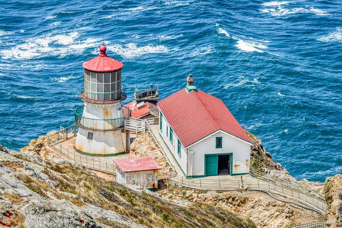
- More than 21 miles and 53 audio stories: Plan on about two to three hours of driving and listening, before adding hikes and detours.
- A one-way route with a fine finish: Start near the Bear Valley Visitor Center and end at the Lighthouse Visitor Center.
- Strongest stops: The Cypress Tree Tunnel, Drakes Beach, the lifesaving station, elephant seal overlook, and Point Reyes Lighthouse area give the drive its best variety.
- Offline access matters: Download the tour over strong Wi-Fi or cellular service before entering the park.
- Great for small groups: One purchase covers up to four people in the car, making it cheaper than four individual tickets.
- Build in extra time: Tomales Point, Drakes Estero, Chimney Rock, and the lighthouse area deserve more than the short audio segments suggest.
What this Point Reyes drive actually feels like
This is not a bus tour, and no guide meets you at the first stop. You drive your own car along the peninsula while the Action Tour Guide app uses your location to play the narration. The result is part road trip, part history lesson, and part nature outing.
The route begins at 1 Bear Valley Visitor Center Access Road near Point Reyes Station and finishes at the Lighthouse Visitor Center at 27000 Sir Francis Drake Boulevard in Inverness. That direction matters. You are not simply circling back to your starting point, so plan your day around ending near the lighthouse.
The stated driving time is two to three hours. That is realistic for the route and audio, but not for a relaxed visit to every stop. The Tomales Point detour alone takes about 45 minutes round trip, before you walk around. Add the Drakes Estero trail, Chimney Rock, beach stops, wildlife viewing, and lighthouse time, and you can easily turn this into a half-day outing.
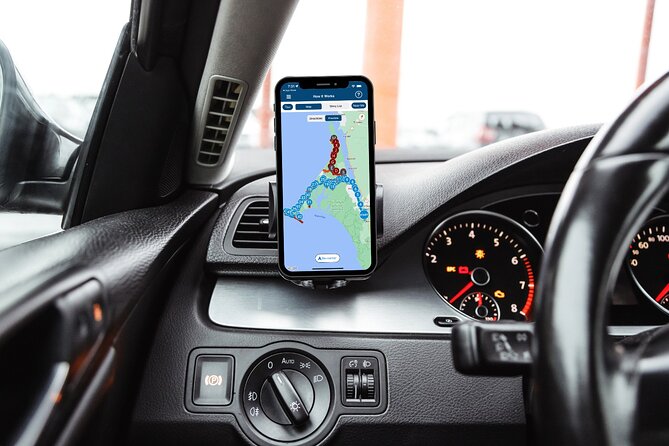
The narration is designed to play hands-free as you drive. You can connect your phone to the car by Bluetooth, USB, or AUX. Apple CarPlay works with audio playback, while Android Auto support is still described as forthcoming. I would set up the phone before leaving town, then keep the driver focused on the road and let passengers handle the app if needed.
More Self-Guided Audio Tours in the USA
- Gettysburg Battlefield Self-Guided Driving Audio Tour
★ 4.5 · 910 reviews - Joshua Tree National Park Self-Guided Driving Audio Tour
★ 4.5 · 762 reviews - Ultimate Acadia National Park Self-Guided Driving Audio Tour
★ 4.0 · 521 reviews
Bear Valley to Tomales Point: the first choice of the day
The first major option is Tomales Point, a remote and windblown part of the peninsula with beaches and broad ocean views. The detour takes about 45 minutes round trip, and you will want extra time for pictures and a short walk.
This is an important planning choice. If you are trying to reach the lighthouse quickly, you may skip Tomales Point. If you have the whole day, the detour gives you a quieter start and a stronger sense of how open and exposed Point Reyes can feel.
The audio does not force you to stop. It tells you when the turn is coming, then you decide. That flexibility is one of the tour’s best features, but you still need to watch road signs and obey the speed limit. The app works best when you follow the planned route and drive at a steady pace.
Drakes Estero and the 2.5-mile walking option
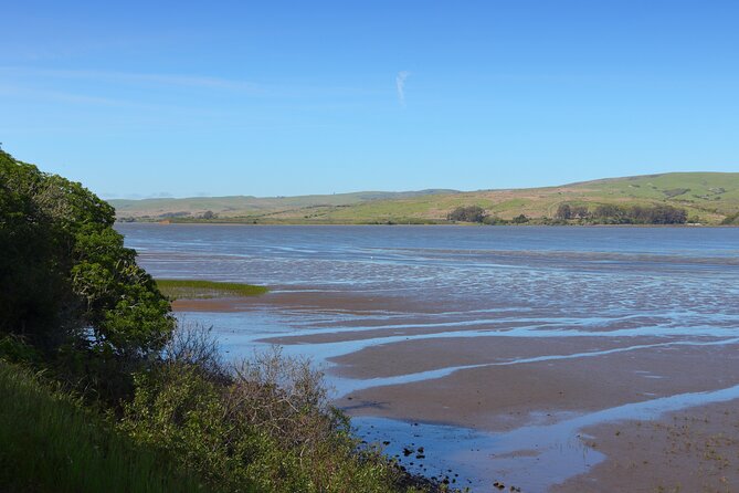
Next comes Drakes Estero, a marshy inlet with coastal grasslands and a footbridge over the bay. The audio explains what an estero is, then points out the trailhead for a 2.5-mile round-trip walk.
You can turn left at the Drakes Estero Trailhead if you want to hike, or continue toward the next stop. That makes this section useful for mixed groups. One person can enjoy a walk while someone else may prefer to keep driving, though you will need to agree on where to meet again.
The short audio segment gives you the basic orientation, not a full hiking guide. Bring your own judgment about time and conditions. If you stop here, the two to three hour estimate no longer tells the full story.
The Cypress Tree Tunnel and KPH Radio Station
The Cypress Tree Tunnel is one of the most memorable stops because it feels unexpected. Rows of cypress trees form a green corridor leading to the historic KPH Radio station.
The story here adds purpose to what might otherwise look like a photogenic road. In 1929, the Radio Corporation of America built the station as part of a coastal Morse code network used to communicate with ships at sea. The cypress rows were planted to fit the station into its surroundings.
I like this stop because it gives you a concrete link between technology and the remote coast. The route is not only about cliffs and ocean views. You also hear how communication stations once lined the American coast and why this particular site was chosen.
Give yourself time to walk through the tunnel and take photos. The audio is listed as a brief stop, but the picture-taking line can be slow if several cars arrive at once.
More Driving Audio Tours in the USA
- Ultimate Lake Tahoe Self-Guided Driving Audio Tour
★ 4.5 · 435 reviews - Scenic Newport, RI Self-Guided Driving Audio Tour
★ 4.5 · 325 reviews - Arches National Park Self-Guided Driving Audio Tour
★ 4.5 · 288 reviews - Yellowstone National Park Self-Guided Driving Audio Tour
★ 4.5 · 249 reviews
Point Reyes Beach and Drakes Beach
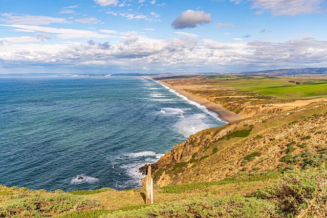
Point Reyes Beach brings a huge stretch of sand and ocean. The beach runs for about 11 miles, and the narration points out that gray whales are sometimes seen from shore in winter and spring.
The beach faces the open ocean, so expect a stronger coastal feel than at Drakes Beach. You may find this a good place for a quick view and a breath of sea air, but the audio cannot promise wildlife sightings. That uncertainty is part of the appeal, and also a reason not to build your whole day around seeing whales.
Drakes Beach faces Drakes Bay, so it is more sheltered from heavy wind and large waves. White sandstone cliffs form the backdrop, giving the stop a different mood from the exposed ocean side.
These two beaches work well together because they show how much the shoreline changes over a short drive. Point Reyes Beach feels broad and open. Drakes Beach feels more protected and easier to linger at.
Chimney Rock, the old lifesaving station, and sea lions
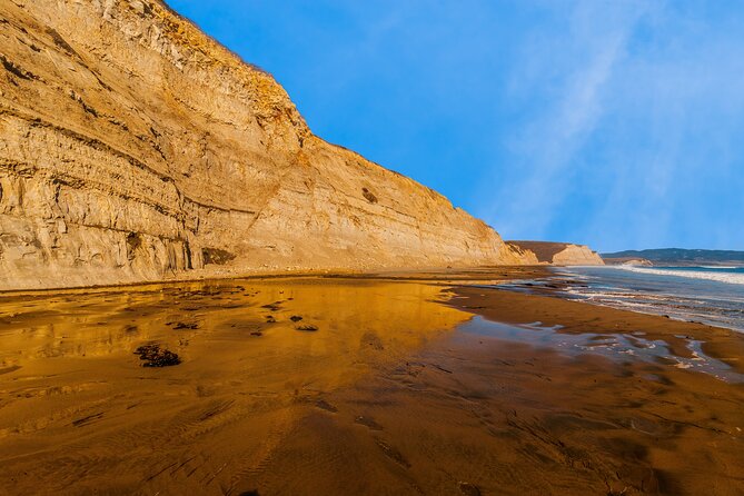
At the fork near Chimney Rock, turn left for several related stops. The road takes you toward the historic Point Reyes Lifeboat Station, an elephant seal overlook, and the trail to Chimney Rock.
The lifesaving station began operating in 1878. Its leader was called the keeper, while the workers were known as surfmen. They patrolled beaches, watched for shipwrecks, and listened for voices in the fog. During its 37 years of operation, the station helped save people from 14 major shipwrecks.
That story gives the point a human scale. You are not just looking at a remote coastal outpost. You are hearing about people whose work depended on patience, weather sense, and a willingness to enter dangerous surf.
The elephant seal stop adds a sharp change of subject. Northern elephant seals were once hunted for their blubber, and by 1892 only about 75 remained along the entire North American coast. Protection by Mexico and the United States in the 1920s helped the population recover. The first breeding pair returned to Point Reyes in 1981, and the Pacific coast population is now estimated at about 200,000.
You may see seals at the overlook, but wildlife is never guaranteed. Keep your distance and use the stop for observation rather than expecting a close encounter.
The Sea Lion Overlook involves 54 steps down to a coastal view. The narration explains the difference between seals and sea lions: sea lions have visible ear flaps and can use their rear flippers to move upright on land.
It also covers their breeding behavior. Males can reach about eight feet, females about six feet, and breeding season runs from May through August. During that period, males defend territory and fast while living on stored fat. Females have a 12-month gestation period and usually give birth in June or July.
The steps make this stop less suitable if you want to avoid stairs, but the view is one of the more distinctive parts of the route. Give yourself time to climb down and back up. The audio segment is short, while the physical visit takes longer.
South Beach, the lighthouse road, and the parking decision
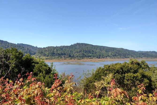
The South Beach Overlook signals that you are nearing the lighthouse area. There is one main parking lot for the lighthouse, and the advice is simple: park there when you arrive.
Street parking is possible if the lot is full, but the area can become congested, especially on weekends. I would not count on finding a convenient space right beside the lighthouse. Arriving earlier gives you more freedom to walk rather than circle for parking.
The lighthouse is reached by a long stairway, but the supplied tour information does not give an exact stair count or guarantee access inside. The audio brings you to the correct area and explains the nearby sights, while the Lighthouse Visitor Center is the stated end point.
This is the natural place to pause the tour. You can finish the last audio stories, walk around, and take in the ocean view without rushing to return to the car.
The Leaning Tree and small details worth noticing
Near the end, the route passes another narrow tunnel of cypress trees. The trees bend toward the hillside, and just beyond them is the Leaning Tree, a cypress that angles over the path without falling.
It is a small stop, but that is exactly why it works. Point Reyes is full of large views, yet details like this give the drive personality. The trees are easy to spot because there are few trees in much of the surrounding area.
The tour is strongest when it calls your attention to places you might otherwise pass. One particularly positive account praised the way it led to beaches, trails, the Cypress Tree Tunnel, and stories beyond the lighthouse. That is the value of having narration during the drive: it helps you notice the less obvious turnoffs.
App setup, GPS, and the weak spot
You receive setup instructions and a password by email and text after booking. Search your messages for audio tour, download the separate Action Tour Guide app, and enter the password. Download the route while you still have strong Wi-Fi or cellular service.
Once onsite, open the app and launch the version with your planned starting point and direction. Drive to the first story point near the Bear Valley Visitor Center Access Road. No one meets you there. The narration should start automatically as you pass the correct location.
This process is simple after setup, but it is not as effortless as buying a ticket and joining a group. Some people may find the start confusing because the tour is not affiliated with the visitor center. Staff there will not have tour-specific instructions.
The GPS system can also replay narration if you drive back through the same points in reverse. One practical fix is to pause the tour when you turn around or finish a side trip, then resume when you are back on the intended route. Detours are not always as obvious on the return drive, so pay attention to the app and road signs.
Support is available from the provider, and a tutorial is offered. Still, I would test the app before reaching the park. That single step removes the biggest source of trouble.
Price, value, and who should buy it
At $16.99 per group of up to four, this is a good buy for a small family or group sharing one car. Four people pay less per person than they would for separate admissions to a conventional guided activity, and you keep control of the day.
The price does not include park passes. You need to account for that separately. The tour also does not provide transportation, meals, a personal guide, or guaranteed wildlife sightings.
The lifetime, no-expiry access improves the value. You can pause the route, use it on another day, or return on a future trip. That matters at Point Reyes because weather, road conditions, hiking energy, and wildlife viewing can change your plans.
I would choose this tour if you want context but dislike being tied to a group schedule. It suits drivers who enjoy scenic roads, families that need flexible stops, and repeat visitors who want a different way to connect the beaches, radio station, wildlife points, and lighthouse.
I would think twice if you are uncomfortable setting up phone apps, expect a person to meet you, or want a polished, fully managed excursion. The information is useful, but the experience depends on your phone, GPS, car stereo, route choices, and attention to directions.
Should you book the Point Reyes audio tour?
Book it if you want a low-cost way to put the whole peninsula in context and you are willing to prepare the app before you arrive. The best parts are the variety of stops, the stories about the KPH Radio station and lifesaving crews, and the freedom to add beaches, trails, wildlife overlooks, and the lighthouse at your own speed.
Skip it if you only want a quick drive to the lighthouse or if app setup is likely to frustrate you. For everyone else, download it early, start near Bear Valley, plan extra hours for walks, and treat the audio as a helpful companion rather than a substitute for your own map and good judgment.
FAQ
How much does the Point Reyes self-guided audio tour cost?
The tour costs $16.99 per group of up to four people.
How long does the tour take?
The driving route takes about two to three hours. Side trips, walks, photos, and beach stops require additional time.
Where does the tour start?
It starts at 1 Bear Valley Visitor Center Access Road, Point Reyes Station, California 94956.
Where does the tour end?
The route ends at the Lighthouse Visitor Center at 27000 Sir Francis Drake Boulevard, Inverness, California 94937.
Is a guide included?
No. This is a private, self-guided activity. No one meets you at the starting point.
What language is available?
The tour is offered in English.
Does the tour work without cell service?
Yes, but you must download it while you have strong Wi-Fi or cellular service. It works offline after downloading.
How do I start the audio?
Download the Action Tour Guide app, enter the password sent by email and text, open the correct tour version, and drive to the starting point. The first story should begin automatically when you reach its location.
Does the price include park admission?
No. Park passes are not included.
Can I use the tour more than once?
Yes. The tour provides lifetime access with no expiry, so you can use it on future trips and pause or resume it as needed.
Latest audio tours in the USA
- Solvang City Personalized Self-Guided App Tour★ 3.0 · 6 reviews
- Essential Downtown SLO: A Self-Guided Audio Tour★ 4.5 · 27 reviews
- Silicon Valley Self-Guided Driving Audio Tour for Tech Lovers★ 4.0 · 24 reviews
- Self-Guided Audio Tour of the Golden Gate Bridge★ 3.5 · 3 reviews
- The Ghosts of San Francisco Haunted Audio App Walking Tour★ 5.0 · 2 reviews
- San Francisco Self-Guided Audio Drive: Explore at Your Own Pace★ 4.0 · 9 reviews
- Explore Coronado Island on a Self Guided Audio Tour★ 5.0 · 2 reviews
- San Diego Gas Lamp: At your leisure & pace. An audio walking tour.★ 3.5 · 4 reviews
Driving Audio Tours, compared.


Ultimate Acadia National Park Self-Guided Driving Audio Tour
Read our review →



Browse the lists this tour appears in