
Reviewed · USA
Rocky Mountain National Park Self-Guided Driving Audio Tour
The best thing about this Rocky Mountain National Park tour is its freedom. You drive your own car, stop when a view catches your eye, and hear short stories begin as you reach each point. There is no bus schedule and no group leader waving you along. The offline map also matters here, since mountain service can vanish without warning.
I like two things in particular: one $16.99 purchase covers up to four people, and the tour stays useful after the first outing because access does not expire. I also like the mix of scenery, park history, Native American heritage, trail suggestions, and practical reminders about overlooks and parking areas.
The main caution is that this is still a driving tour. You must manage the road, parking, weather, closures, and park reservations yourself. The GPS can lag if you stray from the route, and some users have had trouble with audio syncing or downloading the tour correctly.
Key points before you book
- More than 40 miles of mountain roads: The route includes over 60 audio stories and takes about two to three hours without long stops.
- Grand Lake and Bear Lake coverage: The main route ends in Grand Lake, with a separate Bear Lake detour that adds major trailheads and viewpoints.
- Offline operation: Download the tour over strong Wi-Fi or cellular service before entering the park.
- Automatic audio: Stories are designed to play when you reach the correct GPS point, so you can keep your eyes on the road.
- Lifetime access: You can pause the outing, return another day, or use the tour again on a later trip.
- Park admission is separate: You still need the correct park pass and any required timed-entry reservation.
How the audio tour works on the road
After booking, you receive setup instructions and a password by email and text. Search for audio tour if the message is hard to find. Then download the separate Action Tour Guide app, enter the password, and download the tour while you still have a strong connection.
Once you reach the starting point, no guide meets you. You open the app, choose the version that matches your starting point and direction, and let the GPS trigger the stories. The route is designed for hands-free use, but the driver should never fiddle with the phone while moving.
You can connect your phone to the car stereo by Bluetooth, USB, or AUX. Apple CarPlay works with audio playback. The recommended devices are an iPhone with iOS 15 or later, an Android phone with version 9 or later, or an iPad or tablet with GPS and cellular capability.
The app should continue working without cell service after the download is complete. That last part is important. Downloading something to cloud storage is not enough. The tour must be stored on the phone itself. One user had a good experience when the app worked but found that the files had not fully downloaded for offline use.
A little preparation prevents most trouble. Start at the correct point, follow the suggested route and speed, and allow the story to finish before expecting the next one. If you take a detour, the GPS may trigger late. Some users also had to select stops manually or deal with sound that became distorted, so I would keep the confirmation details and support contact handy.
More Self-Guided Audio Tours in the USA
- Gettysburg Battlefield Self-Guided Driving Audio Tour
★ 4.5 · 910 reviews - Joshua Tree National Park Self-Guided Driving Audio Tour
★ 4.5 · 762 reviews - Ultimate Acadia National Park Self-Guided Driving Audio Tour
★ 4.0 · 521 reviews
Starting near Beaver Meadows and the eastern park roads
The supplied meeting point is Harbison Meadows Picnic Site near Grand Lake, but the app may offer more than one route version. Choose the starting point and direction that match your plans. The tour can also be used from the Estes Park side, as one route description covers the drive toward Grand Lake.
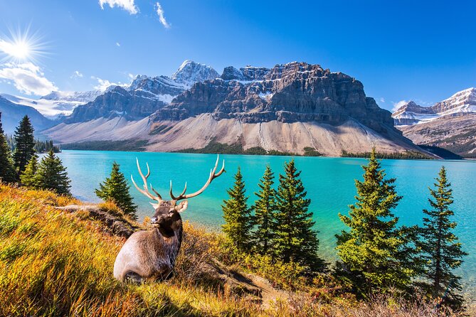
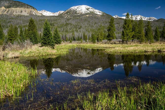
The first area introduces Rocky Mountain National Park and sets up the drive ahead. You move through scenery that includes broad meadows, spruce and fir forests, high passes, and open tundra. The narration also points out wildlife opportunities, though the exact animals you see will depend on the day.
Beaver Meadows Visitor Center is an important early reference point. It is the park headquarters and principal visitor center, so it is a useful place to orient yourself before committing to the longer drive. The tour then points out Deer Mountain Trailhead, where a hike climbs about 1,000 feet toward mountain views. That is a serious uphill walk, not a casual roadside stroll, so treat it as an optional stop.
Beaver Ponds follows with an easy boardwalk through attractive wetlands. This is one of the route’s gentler walking choices and a good contrast to the steep trails farther along. The tour allows roughly an hour at this stop in its itinerary, though your own timing is flexible.
Hidden Valley and the first high overlooks
Hidden Valley comes next, with boreal forest and hardy plants adapted to a difficult climate. The stop itself is listed as brief, but you can pause longer if you want to walk, take photographs, or simply let the mountain air slow the day down.
The road then rises toward a series of overlooks. Many Parks Curve gives you views across three mountain meadows. It is the kind of stop where the audio helps you notice the shape of the land rather than simply pulling over for a quick photograph.
Rainbow Curve marks the zone where trees begin to thin out and eventually disappear at higher elevations. The views open wider here, but high roads bring changing weather and colder conditions. Do not judge the temperature at the lower entrance by what you will find near the upper viewpoints.
At Ute Trailhead, the narration turns to the Ute people who lived in the Rockies. Forest Canyon Overlook adds information about the Arapaho people while giving you a view from near 12,000 feet. These cultural sections are valuable because the park is more than a collection of scenic pullouts. Still, the depth of the stories varies, and one local user felt the tour offered too little about geology, wildlife, and the mountains themselves.
Lava Cliffs Overlook provides a geological surprise. The cliffs are described as 28 million years old, a reminder that volcanic forces helped shape parts of the Rockies. Gore Range Overlook follows, named for the deep red color the range can take on at certain times of day.
Trail Ridge Road highlights near 12,000 feet
The Alpine Visitor Center is one of the most practical stops. It offers snacks and restrooms and is the highest-elevation visitor center in any US national park. It is also a natural place to pause before continuing through the high country.
Medicine Bow Curve gives you a far-reaching view that can extend into Wyoming. Poudre Lake is an alpine lake that freezes all the way through in winter. Fairview Curve then looks toward the Never Summer Mountain Range.
This stretch is a major reason to use an audio guide instead of simply driving with a silent map. The road connects a long line of overlooks, and the app gives you context before you arrive. One particularly useful feature is its warning about scenic pullouts and trails, which helps you decide where to stop without constantly studying a paper map.
The drawback is the road itself. At high elevation, conditions can change, and closures can break the route into separate sections. The supplied information notes a temporary winter closure on Trail Ridge Road, with the east side closed at Rainbow Curve and the west side closed at Colorado River Trailhead. Old Fall River Road was also closed at that time. Check current conditions before you leave, since the audio cannot guide you through a road that is shut.
More Driving Audio Tours in the USA
- Ultimate Lake Tahoe Self-Guided Driving Audio Tour
★ 4.5 · 435 reviews - Scenic Newport, RI Self-Guided Driving Audio Tour
★ 4.5 · 325 reviews - Arches National Park Self-Guided Driving Audio Tour
★ 4.5 · 288 reviews - Yellowstone National Park Self-Guided Driving Audio Tour
★ 4.5 · 249 reviews
Colorado River Trail and the western side
Colorado River Trail is one of the longer stops, with about an hour listed for exploring. The trail gives you views of the Colorado River and explains some of the river’s less obvious history. If you want walking time during the drive, this is one of the better places to build it in.
Timber Creek Road Camp Barn offers a look at the work behind the park road system. The route was not built quickly or easily, and this small historic stop adds useful context to the engineering effort.
Holzwarth Historic Site takes you into an earlier period, when the property was a family home and later one of the first dude ranches in the country. It is a good change of pace from overlooks because it connects the park to human use before national park protection.
Bowen and Baker Trailhead marks the beginning of one of the park’s longer trails. It suits experienced hikers who have planned for a demanding outing, not people trying to squeeze in a short walk before lunch.
Coyote Valley Trail is the easier option in this section. It is shorter and includes fishing opportunities. Onahu Trailhead adds another Native American connection, with information about the Onahu people.
The main route concludes in Grand Lake. The town provides food, restrooms, and other services after the drive. Ending here makes sense if you want to turn the audio tour into a one-way crossing rather than a tight loop.
The Bear Lake detour and eastern trailheads
The Bear Lake detour is where the tour becomes more trail-focused. It begins with Moraine Park Amphitheater, a site connected to the park’s early development. Moraine Park itself offers scenic horseback riding, so this section can appeal to visitors who want more than a roadside viewpoint.
Cub Lake Trailhead introduces the effects of wildfires in the park. Fern Lake Trailhead is aimed at hikers seeking a quieter outing away from the busiest points. These are not quick photo stops if you plan to hike, so allow extra time beyond the advertised two to four hours.
Odessa Lake and Flattop Mountain Junction brings you near Eagle Cliff Mountain, named for golden and bald eagles that are often seen in the area. Hollowell Park follows with picnic tables and views across Mill Creek Basin toward Longs Peak. The itinerary gives this stop about an hour, making it a sensible place for lunch.
Sprague Lake is highlighted as a strong sunrise location. That advice comes with a practical warning: you need to arrive early to make the most of it. Bierstadt Lake offers another scenic lake and is described as a quieter choice than Sprague Lake.
Glacier Gorge Junction leads into a trail area known for quaking aspens. Finally, Bear Lake provides a fitting endpoint for the detour, with a large body of water, mountain scenery, and plenty of reason to stop for final photographs.
Keep the reservation rules in mind here. Timed-entry permits were required during the listed 2025 peak-season dates, and the Bear Lake Corridor had its own access window. The exact rules can change, so check the park’s current system before you set out. A ticket for the audio tour does not include park admission or timed entry.
What $16.99 really buys you
At $16.99 per group of up to four, the value is strongest when you fill a car. A family or group of friends pays one price instead of buying four seats on a guided excursion. You also avoid the fixed schedule and limited stop times that come with a large vehicle.
The price does not cover the park pass, fuel, food, hiking equipment, or any reservation fee. It also does not replace a park ranger. I would use the app for route context and stories, then ask a ranger about current road conditions, wildlife safety, trail status, and weather.
The lifetime access is a real advantage. You can pause during a long day, return to the park later, or use the tour again on another trip. That makes it easier to split the drive into sections instead of forcing every overlook and trail into one outing.
Who will get the most from this tour
I would recommend it most to first-time visitors who want structure without a group. It is also a strong choice for families, since children can hear background information while the car keeps moving, and everyone can stop when needed.
The app suits independent drivers who are comfortable managing their own day. You can skip a trail, replay a story, or pause for lunch. Couples and small groups will appreciate the privacy, while visitors who prefer a live expert answering questions may find the format limited.
The tour is less convincing for someone who already knows Rocky Mountain National Park well and wants detailed geology, wildlife science, or fresh interpretation at every stop. The content is strongest as a practical introduction with historical and scenic commentary. It is not a substitute for a full naturalist-led program.
Cancellation and basic planning
Free cancellation is available when you cancel at least 24 hours before the scheduled start time. Changes or cancellations inside that window are not accepted for a refund.
Set up the app before entering the park. Confirm that the map and audio files are stored on your phone, connect the phone to your car stereo, and choose the correct route direction. Keep the driver focused on the road, and let a passenger handle the app if a manual selection becomes necessary.
Should you book the Rocky Mountain audio tour?
Book it if you want an inexpensive private guide for a major scenic drive and you are willing to prepare your phone before arrival. The automatic stories, offline map, flexible timing, and one-car pricing make it a practical choice for families and small groups.
Skip it if you expect a live guide, dense natural science, or guaranteed operation despite road closures and weak setup. I would especially avoid treating the two to three hour estimate as a full park day. With hikes, picnics, traffic, viewpoints, and the Bear Lake detour, you may want much longer.
For most first visits, the price is low enough to justify the experiment. Just download it properly, check permits and road conditions, and let the park itself set the pace.
FAQ
How much does the Rocky Mountain National Park audio tour cost?
The tour costs $16.99 per group of up to four people. One purchase is enough for everyone in the car.
How long does the tour take?
The driving route covers more than 40 miles and takes about two to three hours without lengthy stops. The overall experience can take two to four hours or longer if you add hikes, meals, viewpoints, or the Bear Lake detour.
Does the tour include park admission?
No. Park passes are not included. Timed-entry permits, when required by the park, must also be arranged separately.
Does the tour work without cell service?
Yes, after you fully download the tour and map while you have strong Wi-Fi or cellular service. The files must be downloaded directly to your phone, not left only in cloud storage.
Where does the tour start and finish?
The listed start and end point is Harbison Meadows Picnic Site near Grand Lake. The app may offer different versions, so choose the one that matches your starting point and direction.
Does a guide meet you at the starting point?
No. This is a private, self-guided activity. You open the Action Tour Guide app at the starting point and follow the GPS-triggered stories.
Can I pause the tour?
Yes. You can pause the tour for snacks, photos, hikes, or other side trips and resume later. Lifetime access also lets you use it on another day or another trip.
Does the audio play automatically?
The stories are designed to start automatically when you reach their GPS locations. Staying on the suggested route and following the speed limit helps the audio stay in sync.
Can I use the tour with my car stereo?
Yes. You can connect your phone by Bluetooth, USB, or AUX. Audio playback is compatible with Apple CarPlay.
What should I do if Trail Ridge Road is closed?
Check current park conditions before leaving and confirm which sections are open. The supplied conditions note a temporary closure on sections of Trail Ridge Road and a closure of Old Fall River Road, but road status can change.
More National Park Audio Tours in the USA
- Self-Guided GPS Audio E-Bike Tour Hawaii Volcanoes National Park
★ 4.5 · 131 reviews - Shenandoah National Park Self-Guided Driving Audio Tour
★ 4.5 · 109 reviews - Self-Guided Audio Driving Tour in Glacier National Park
★ 4.5 · 101 reviews - Self-Guided Audio Driving Tour in Mesa Verde National Park
★ 4.5 · 86 reviews
Latest audio tours in the USA
- Solvang City Personalized Self-Guided App Tour★ 3.0 · 6 reviews
- Essential Downtown SLO: A Self-Guided Audio Tour★ 4.5 · 27 reviews
- Silicon Valley Self-Guided Driving Audio Tour for Tech Lovers★ 4.0 · 24 reviews
- Self-Guided Audio Tour of the Golden Gate Bridge★ 3.5 · 3 reviews
- The Ghosts of San Francisco Haunted Audio App Walking Tour★ 5.0 · 2 reviews
- Point Reyes National Seashore Self Guided Driving Audio Tour★ 4.0 · 9 reviews
- San Francisco Self-Guided Audio Drive: Explore at Your Own Pace★ 4.0 · 9 reviews
- Explore Coronado Island on a Self Guided Audio Tour★ 5.0 · 2 reviews
Driving Audio Tours, compared.

Ultimate Acadia National Park Self-Guided Driving Audio Tour
Read our review →


Browse the lists this tour appears in