

Reviewed · MOAB
Arches and Canyonlands NP Self-Guided Driving Audio Bundle Tour
The best thing about this Arches and Canyonlands tour is simple: your phone becomes a GPS-triggered guide while you drive. Stories begin near the right turn or viewpoint, so you can enjoy the red-rock scenery without constantly studying a map. I especially like the clear trail advice and the freedom to stop, pause, repeat, or skip sections.
I also like the price: $24.99 per car, not per person, for up to four people. The offline function is a major help in these remote parks. The catch is that you must download the app and tours before entering the parks, and a few audio or navigation glitches have been reported when driving in the opposite direction or changing course.
Key points at a glance
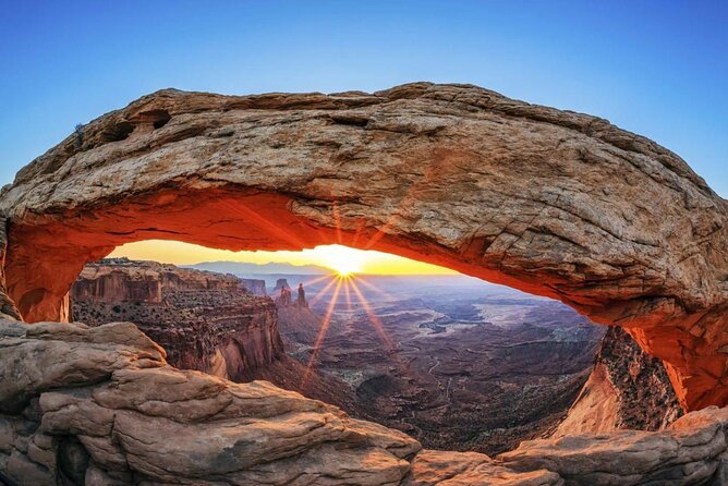
- More than 49 audio stories per park tour: Learn about geology, Native peoples, settlers, myths, and park history while you drive.
- Two separate routes: Each tour covers more than 28 miles and usually takes about two to three hours, depending on stops.
- Offline GPS guidance: Download everything over strong Wi-Fi or cellular service before heading into the parks.
- Flexible private touring: Start, pause, repeat, skip, or resume the route over multiple days.
- Strong value for families: One purchase covers a car of up to four people, including passengers who may not be able to hike.
- No park admission included: You still need to buy entry passes and handle any required reservations yourself.
What this audio bundle actually does

This is not a bus tour and no guide meets you at the entrance. You drive your own car, open the Action’s Tour Guide app, choose the correct park and starting direction, and follow the route. When you approach a programmed point, the narration plays automatically through your phone or car stereo.
That hands-free design is the heart of the experience. You can listen while moving between trailheads, then pause the commentary when you stop for photos or a hike. If a story passes too quickly, you can replay it manually. If a stop does not interest you, skip ahead.
The content mixes practical instructions with short stories. You hear about rock layers, erosion, biological soil crust, Native traditions, Spanish and Mormon settlers, cowboys, ranchers, and the people who fought to preserve these parks. The approach is more engaging than trying to read every sign while managing a busy day.
The narrator’s name is not provided, but the voice is described as clear and easy to follow. The tour is offered in English only.
More Self-Guided Audio Tours in the USA
- Arches National Park Self-Guided Driving Audio Tour
★ 4.5 · 288 reviews - Canyonlands National Park Self-Guided Driving Audio Tour
★ 4.5 · 54 reviews - Utah Mighty 5 National Parks Self-Guided Driving Audio Tours
★ 4.5 · 25 reviews
Arches begins with geology and unlikely rock shapes
The Arches route starts just before the park entrance and visitor center. That is useful because the introduction begins before you are fully committed to the park road. You get an explanation of the region’s ancient rock formations and the forces that shaped this dry, red world.
One early point of interest is Moab’s Fault, a crack in the earth’s crust estimated at six million years old. The app uses it to explain the pressure and movement behind the scenery around Arches. This is the kind of detail that helps you read the rock instead of seeing it as one endless wall of red stone.
You also get a look toward the La Sal Mountains, Utah’s second-highest mountain range. The highest peak is nearly 13,000 feet tall. The sharp contrast between snowy or dark mountain peaks and the desert floor makes this a worthwhile pause, even though the main attraction here is the stone.
The narration also addresses Spanish settlers and the displacement of Ute and Paiute communities. That historical context matters. Arches is not just a collection of spectacular formations, and the tour makes room for the people connected to this place.
Three Gossips, the Windows, and Cove of Caves
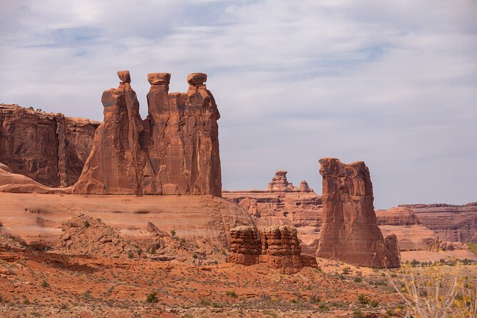
The Three Gossips is one of the first named formations on the route. You have about ten minutes listed for the stop, but the app does not force you to stay on a schedule. Use that time for a quick look, or linger if the light and crowd levels are good.
The road then brings you past formations such as the Organ, Courthouse, and Sheep Rock. The narration helps you identify them from the road, which is handy when several huge shapes appear at once and you are not sure which one is which.
The Windows Road leads to one of Arches’ essential stops. The Windows are broad openings carved into sandstone, and the route treats them as a major point rather than a quick drive-by. Plan extra time here if you want to walk beyond the basic viewpoint.
Cove of Caves offers another example of erosion at work. You look down the trail toward a cluster of arches and partial arches. The stop is listed at about ten minutes, but you should regard that as a suggested pause, not a full visit.
Along the way, the tour points out the Petrified Dunes and Great Wall. It also brings in Ute and Paiute stories connected to the region. These stories add a human layer to scenery that can otherwise feel distant and unfamiliar.
Delicate Arch and the middle of the park
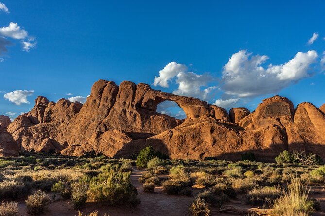
The Delicate Arch section is the emotional center of the Arches route. The narration identifies it as the park’s most famous formation and explains that a short hike brings you close to it. The supplied information does not give a trail length or difficulty here, so check current park information before choosing your hike.
Do not treat the audio tour as a replacement for park signs or trail information. It tells you what is coming and why it matters, but you still need to judge heat, water, footing, and your own ability.
The drive continues toward Salt Valley, a quieter area formed when sandstone domes collapsed. Broken rock on the ground is part of that story. The route also passes the Fiery Furnace, a maze of narrow canyons and passages below towering red cliffs.
Fiery Furnace is a good example of where the audio helps you understand a place even if you do not enter it. The tour explains what you are seeing from the road, while you decide whether a separate visit fits your day.
The final Arches section reaches Devils Garden Trailhead. This is where the driving route ends, with access to the trail toward Landscape Arch and beyond. The route’s geology and cultural stories come together here, making Devils Garden a fitting finish.
Each Arches tour covers more than 28 miles and includes more than 49 audio stories. The full drive is usually two to three hours before you add hikes, meals, photographs, and traffic delays.
More Driving Audio Tours in Moab
- Full-Day Audio Driving Tour of Arches National Park
★ 4.5 · 27 reviews - Self Guided Audio Driving Tour in Arches National Park
★ 3.5 · 6 reviews - Goblin Valley Self Guided Driving Audio Tour
★ 4.0 · 4 reviews - Self Guided Audio Driving Tour of Canyonlands
★ 5.0 · 2 reviews
Canyonlands changes the scale of the day
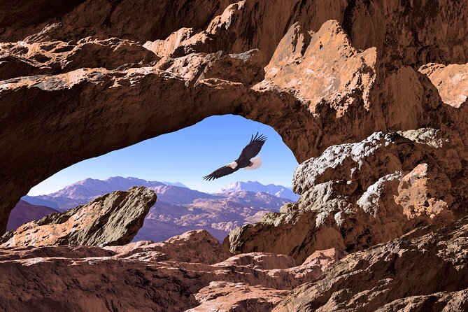
The Canyonlands portion shifts from tightly packed arches to vast canyon views. The route includes the Island in the Sky area and several overlooks, but you need to pay attention to direction. One useful lesson from actual use is that the GPS system works best when you follow the route in one direction.
If you turn around or take a return road, the app may replay a segment or become confused about your position. The system can still recover, but you may need to control playback manually. That is not a dealbreaker, but it is worth knowing before you improvise.
Near Sevenmile Canyon, tall walls close in around the road. As you emerge, the Merrimac and Monitor formations appear in the distance. The names reflect the shapes of the rock, and the narration gives you something specific to watch for rather than leaving you to guess at every formation.
Big Mesa Viewpoint offers another short pause. The huge mesa looks almost misplaced against the surrounding desert. These brief overlooks are useful if you have only one day, since you can see a great deal without committing to a long trail.
White Rim Road and the fragile soil beneath your feet
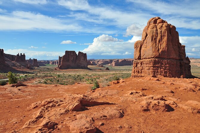
At White Rim Road, the tour explains the temptation to leave the main route and explore farther. It also gives an important warning about biological soil crust.
This dark, living crust can look like ordinary dirt, but it helps hold the dry soil together. Stepping on it can cause damage that takes years to repair. The audio’s reminder is practical, especially if you are tempted to walk across open ground for a better photograph.
The route then reaches Dead Horse Point. The name comes with a grim local story about wild mustangs that were penned here in the early 1800s. Once the desirable horses had been taken, the rest were left behind.
Dead Horse Point is not the same as Canyonlands National Park, and admission costs may apply to side trips. The tour materials do not include attraction passes or entry tickets, and one use of the audio raised concern that the fee was not made clear. I would confirm current entrance requirements before setting out.
The Canyonlands visitor center is another useful point on the route. It is a place to use the bathroom, fill water bottles, and pick up supplies. Infrastructure is limited in the park, so do not wait until you are thirsty or running low.
Mesa Arch, canyon overlooks, and the Green River
Mesa Arch is one of the route’s must-do stops. From the parking area, a short trail leads to the arch, with pinyon and juniper trees along the way. The arch frames the canyon beyond it, and the short walk makes this one of the easier high-value stops in the park.
The app also points out local names connected to cowboys and ranchers. Ned Chaffin’s family, for example, is linked to a nearby spring. These small details give names and stories to places that could otherwise blur together during a long drive.
At Green River Overlook, you can see the river continuing its work on the canyon walls. The Green River runs for about 730 miles and is Utah’s largest stream. The name may come from green soapstone along its banks.
The route continues to places with Native granaries, some of them hundreds of years old. The audio tells you where to look, but treat these sites with care. They are not props for a photograph, and the instructions specifically warn you to be cautious near them.
The discussion of rock layers returns here. In much of Canyonlands, the layers have remained in place since they formed hundreds of millions of years ago. Candlestick Tower, with its white, reddish-brown, and red bands, is an easy example to spot from the road.
Murphy Point, Buck Canyon, and a sensible lunch stop

Murphy Point Overlook requires an easy trail of up to 3.5 miles round trip. The trail itself may not offer constant scenery, but the view at the end looks over Stillwater Canyon and the Green River.
Buck Canyon offers a shorter, more accessible viewpoint. The trail is paved, and a rail separates you from the canyon edge. If heights make you uneasy, this is one of the better overlook choices in the route.
There is also a picnic area with only eight tables. It is a sensible place for a quick meal, but the limited seating means you should not count on finding an open table at the busiest time.
The Canyonlands route finishes after these viewpoints. The bundle also mentions a separate Needles District tour with Newspaper Rock, Pothole Point, and Wooden Shoe Overlook. That is useful if you plan to visit more of Canyonlands, but do not assume the Island in the Sky route automatically covers the Needles District.
Price, timing, and practical value
At $24.99 per group of up to four, the cost is easy to justify if you are sharing one car. A family of four pays roughly $6.25 per person, while a couple pays about $12.50 each. That is far less than a private guide and gives you control over the day.
The value improves if you use the app on more than one day. The current information describes access as lifetime with no expiry, so you can pause the Arches route, return later, and use it again on another trip. Earlier customer support language referred to one year, so I would save your confirmation details and check the access terms shown at booking.
The advertised bundle takes roughly seven to eight hours overall, while each park route takes about two to three hours before hikes and stops. You can use both in one long day, but I would prefer at least two days if you want to walk at Delicate Arch, explore the Windows, visit Mesa Arch, and stop at several overlooks.
Before leaving Moab, download the separate Action’s Tour Guide app, enter the password sent by email and text, and download the tour files over strong Wi-Fi or cellular service. Do not wait until you reach the park entrance. Poor service is one of the clearest ways to turn a cheap audio tour into a frustrating morning.
Connect your phone to the car by Bluetooth, USB, or AUX. The audio works with Apple CarPlay, while Android Auto support is described as forthcoming. An iPhone running iOS 15 or later, or an Android device running version 9 or later, is recommended. A tablet needs GPS and cellular connectivity.
Who will get the most from this tour
I would choose this for families, couples, and small groups who want more context than a park map provides but do not want to join a fixed group. It also works well if one person in your car cannot hike, since the stories and viewpoints can still be enjoyed from the vehicle.
It is especially useful for first-time visitors who are unsure which turnoffs matter. The narration gives advance notice of viewpoints, trails, distances, and the type of stop ahead. That makes it easier to plan your energy and not miss the main sights.
I would be more cautious if you dislike phone-based navigation or expect a live guide to answer questions. The app is not perfect. A few users had trouble with downloads, passwords, cut-off audio, odd sounds while offline, or location confusion after changing direction.
Most of those problems are preventable by downloading ahead of time, following the route, and keeping the support contact information handy. Still, the technical risk is real, and you should not rely on the app as your only source of navigation or safety information.
Should you book the Arches and Canyonlands audio bundle?
Book it if you want a low-cost private guide that works around your schedule. The strongest reasons are the GPS-triggered stories, offline access, useful trail pointers, and the ability to use one purchase for everyone in the car.
Skip it if you prefer a human guide, dislike troubleshooting apps, or plan to drive randomly between viewpoints. For most independent visitors, though, the $24.99 price is fair, especially if you use the lifetime access on more than one day.
Download everything before you leave Moab, keep the phone connected to the car stereo, follow one direction at a time, and confirm park and side-trip fees separately. With those simple precautions, the bundle can add much-needed context to two parks that are easy to admire but much better understood.
FAQ
How much does the Arches and Canyonlands audio bundle cost?
The price is $24.99 per group of up to four people. It is purchased per car rather than per person.
How long does the full experience take?
The combined experience is estimated at seven to eight hours. Each individual park tour covers more than 28 miles and takes about two to three hours before adding hikes and extended stops.
Does the tour include park entrance tickets?
No. Attraction passes, entry tickets, and reservations are not included. You need to purchase entrance tickets for Arches and Canyonlands through the official national park website.
Does the audio work without cell service?
Yes, after you download the tour. You must download the app and tour files while you have strong Wi-Fi or cellular service, then use the tour offline in the parks.
Will a guide meet me at the entrance?
No. This is a private, self-guided activity. You go to the starting point, open the app, and begin the first story yourself.
How does the audio start?
The app uses your phone’s GPS. When you reach the first story point, the narration begins automatically, and later stories play as you reach their locations.
Can I pause or use the tour on another day?
Yes. You can pause the tour, take breaks, skip stops, and resume later. The current information describes access as lifetime with no expiry.
What phone do I need?
An iPhone running iOS 15 or later, or an Android device running version 9 or later, is recommended. An iPad or tablet should have GPS and cellular connectivity.
Can I connect the app to my car stereo?
Yes. You can connect through Bluetooth, USB, or AUX. Audio playback is compatible with Apple CarPlay.
More Self-Guided Audio Tours in Moab
- Self Guided Audio Tour in Arches and Canyonlands
★ 4.5 · 16 reviews - Canyonlands National Park Self-Guided Audio Tour
★ 4.0 · 5 reviews - Utah Mighty 5 Adventure Bundle: 8 Self-Guided Audio Tours
★ 5.0 · 4 reviews - La Sal Mountain Loop Self-Guided Audio Tour
★ 3.5 · 4 reviews
Latest audio tours in Moab
- Utah Mighty 5 Adventure Bundle: 8 Self-Guided Audio Tours★ 5.0 · 4 reviews
- Utah Mighty 5 National Parks Self-Guided Driving Audio Tours★ 4.5 · 25 reviews
- Goblin Valley Self Guided Driving Audio Tour★ 4.0 · 4 reviews
- Self Guided Audio Driving Tour of Canyonlands★ 5.0 · 2 reviews
- Self Guided Audio Tour Bundle for Utah’s Mighty Five★ 5.0 · 3 reviews
- Canyonlands National Park Self-Guided Audio Tour★ 4.0 · 5 reviews
- La Sal Mountain Loop Self-Guided Audio Tour★ 3.5 · 4 reviews
- Self Guided Audio Driving Tour in Arches National Park★ 3.5 · 6 reviews
Driving Audio Tours, compared.


Ultimate Acadia National Park Self-Guided Driving Audio Tour
Read our review →


Browse the lists this tour appears in