

Reviewed · CANADA
Icefields Parkway Self-Guided Driving Audio Tour
The best thing about this Icefields Parkway audio tour is that it turns a beautiful but sometimes confusing drive into a running story. As you leave Jasper, the app points out glaciers, waterfalls, mountain peaks, trailheads, and small details you could easily miss from behind the wheel. The route stretches more than 140 miles toward Lake Louise and includes over 76 audio stories.
I like the freedom to stop for a short walk, skip a crowded viewpoint, or pause the narration for lunch. I also like the price: $16.99 per group of up to four, rather than a charge for each person. The main drawback is the setup. You must download a separate app, enter a password, and load the tour over a strong connection before driving.
Key points to know before you go
- GPS-triggered narration: Stories begin as you reach each point, so you can keep your eyes on the road.
- More than 76 stories: The route covers mountain peaks, glacial lakes, waterfalls, trails, and local history.
- One price per car: At $16.99 for up to four people, the cost is low if you are sharing a vehicle.
- Offline operation: Download the tour before entering areas with weak or missing cellular service.
- Flexible timing: The advertised drive takes about three to four hours, but stops, hikes, meals, and photos can make your day much longer.
- Choose the correct direction: The supplied tour information contains both Jasper and Lake Louise references, so confirm your starting version before setting out.
What this Icefields Parkway tour actually does
This is not a bus tour and no guide meets you at the starting point. You drive your own car, connect your phone to the vehicle by Bluetooth, USB, or AUX, and let the app follow your location. As you reach a point of interest, the narration starts automatically.
That hands-free setup is the real value. You do not need to keep checking a map or read a long list of stops while driving. The audio tells you what is coming, gives you a reason to pull over, and explains what you are seeing once you arrive.
The narration is in English. The tone and pace are designed for a long scenic drive, with stories about geology, exploration, mountain names, waterfalls, and the people who helped map the Rockies. There is no music between points, which some people may miss, but the steady commentary keeps the road from becoming a silent transfer between viewpoints.
The tour is sold by Adventures with Action. You receive setup instructions and a password by email and text after booking. Search for audio tour if the message is hard to find. Download the separate Action’s Tour Guide app while you have strong Wi-Fi or cellular service. Once the tour is loaded, it works offline.
More Driving Audio Tours in Canada
- Icefields Parkway: a Smartphone Audio Driving Tour
★ 4.0 · 118 reviews - Cabot Trail: a Smartphone Audio Driving Tour
★ 4.5 · 118 reviews - Smartphone Audio Driving Tour between Banff and Calgary
★ 4.0 · 25 reviews
Start in Jasper, and check the route before leaving
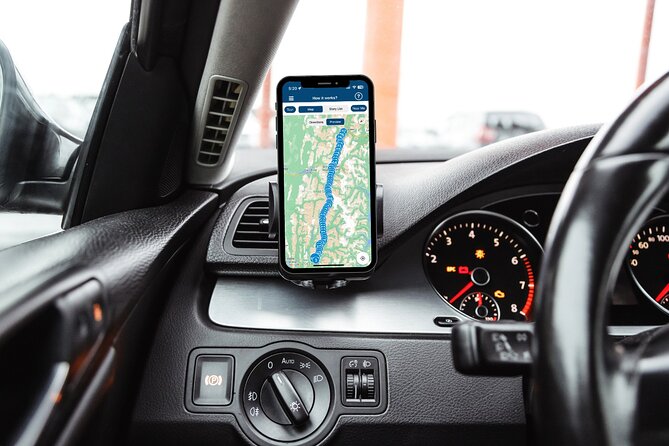
The Jasper version begins in Jasper and ends toward Lake Louise. The directions also describe a Lake Louise version that runs in the opposite direction. This matters. The Icefields Parkway can be reached from more than one place, and the app may contain multiple tour versions.
Before you drive, open the app and select the version that matches your starting point and direction. If you are beginning in Jasper, do not accidentally launch the Lake Louise version. If you are beginning near Banff or Lake Louise, use the reverse version instead.
The route is long enough that I would not treat the three to four hour estimate as a complete day plan. That figure describes the drive and audio content, not a relaxed schedule with hikes. If you stop at the waterfalls, take a trail, visit a viewpoint, and pause for food, allow much more time.
Jasper SkyTram and the Valley of the Five Lakes
Near Jasper, the narration introduces the Jasper SkyTram, Canada’s highest and longest aerial tramway. The story connects the tramway area with Whistler Mountain and the early days of skiing, when skiers had difficult climbs back up after racing down the slopes.
The first named stop is the Valley of the Five Lakes Trailhead. The trail covers about three miles and takes roughly an hour and a half. It is moderately challenging and passes five lakes with unusually strong blue and turquoise colors.
This is a good early stop if you want a walk before settling into the long drive. The audio explains why glacial water can appear so bright. If you are trying to reach Lake Louise in only a few hours, you may prefer to note the trail and save it for a separate Jasper day.
Next comes Athabasca Pass Lookout, with views toward the South Jasper Mountain Range and Mount Edith Cavell. The mountain rises to 11,033 feet. This is a short viewpoint stop, useful for getting your first broad sense of the mountains around the parkway.
Horseshoe Lake, Athabasca Falls, and Mount Kerkeslin
Horseshoe Lake is known for steep rock faces and cliff jumping. The narration describes the 75-foot drop and the cold water below. You can appreciate the dramatic setting without copying the thrillseekers. The information provided does not include safety guidance for jumping, so I would treat the story as an explanation of the site, not an invitation.
Athabasca Falls is one of the route’s essential stops. The waterfall drops about 75 feet into a canyon carved by the Athabasca River. The audio connects the canyon to glacial change during the last Ice Age, giving you a simple explanation for how the river gained its channel.
Mount Kerkeslin rises to 9,790 feet and is the highest peak in the Maligne Range. The narration places the mountain in the story of early exploration, when reaching and naming these peaks was a serious task rather than a scenic side trip.
At Goats and Glacier Lookout, you may see mountain goats drawn to mineral-rich rock, especially salt. The viewpoint also looks over the Athabasca River and the Fryatt Mountain Range. This is the kind of detail a driving tour handles well: you get a reason to look closely instead of simply hearing another mountain name.
More Self-Guided Audio Tours in Canada
- Self Guided Audio Driving Tour of the North Shore of PEI
★ 4.0 · 24 reviews - Self-Guided Audio Driving Tour in Icefields Parkway
★ 5.0 · 24 reviews - Self-Guided Audio Tours for the Canadian Rockies
★ 5.0 · 18 reviews - Discover the Rockies: 6 Self-Guided Smartphone Audio Tour Bundle
★ 4.0 · 10 reviews
Honeymoon Lake, Sunwapta Falls, and the middle stretch
Honeymoon Lake offers reflected mountain views and the chance to see canoes on the water. The stop is short, but it gives you a quieter contrast to the more famous waterfalls and glacier viewpoints.
Sunwapta Falls requires an easy trail of about two miles and a little over an hour. Fed by the Athabasca Glacier, the falls drop about 60 feet. The name comes from the Stoney-Nakoda word for turbulent water, a fitting description once you see the force of the river.
The next part of the route moves through a string of quick viewpoints. Endless Chain Ridge is a group of craggy peaks formed from rock dating to the Jurassic period. The audio explains how pressure beneath the crust later pushed the rock upward.
Poboktan Creek Trail is mentioned mainly to show scale. The trail runs about 24 miles and takes roughly four days, so it is not a casual add-on to this drive. The point is useful: the parkway offers access to serious backcountry routes, but you should not confuse a roadside stop with a short hike.
Beauty Creek is fed by glacial meltwater and leads farther into the wilderness toward Stanley Falls. The route includes seven other cascades before reaching that 40-foot waterfall. In cold months, the cascades can freeze into sheets of ice.
Stutfield Glacier and the Columbia Icefield area
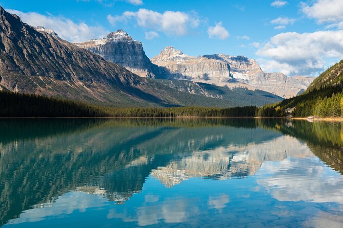
Stutfield Glacier Viewpoint gives you a direct look at a large glacier from the parkway. The ice stretches about 3,000 feet down a cliff face, with double icefalls where the bed becomes steeper and the ice speeds up. The narration also explains why those faster sections form crevasses, an important reminder that a glacier is moving ice, not a harmless snowfield.
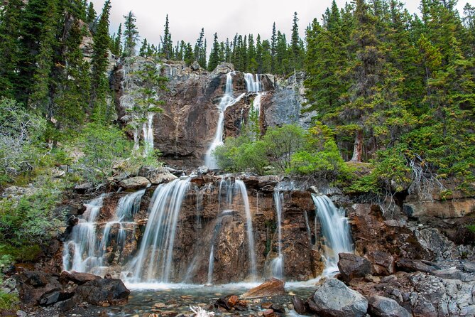
Tangle Creek Falls drops about 90 feet beside the road. Spray can reach the roadway, making this one of the easiest waterfalls to notice without a long walk. The story also introduces Mary Schäffer Warren, who named Tangle Creek and Endless Chain Ridge, and Samson Beaver, a Stoney-Nakoda guide who accompanied her on many journeys.
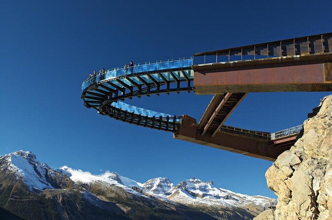
The Columbia Icefield Skywalk is another major attraction along this stretch. Its glass-bottom walkway reaches about 100 feet over the Sunwapta Valley, with the valley floor more than 900 feet below. The audio tells you what to expect, but the Skywalk itself is not included in the $16.99 tour price. Attraction tickets, reservations, and passes are separate.
Mount Kitchener rises to 11,499 feet, making it the tallest peak highlighted on this route. The narration explains its connection to Horatio Kitchener, a British earl who died during the First World War. The naming story adds a human detail to what might otherwise be another impressive but unfamiliar peak.
Three glacier trails for different levels of energy
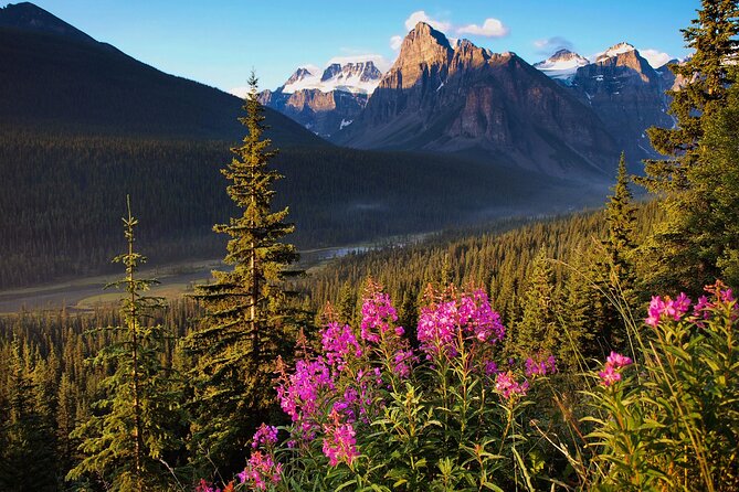
The Toe of the Athabasca Glacier Trail is just over one mile and rated moderate. It gives you a closer view of the glacier and is one of the more practical walks for fitting into a driving day.
Wilcox Pass Trail is much more demanding, covering about seven miles. You do not need to complete the whole route to benefit from it. Many people walk a little over a mile to a viewpoint facing Mount Snow Dome, then return to the car.
Parker Ridge offers another longer option. The four-mile hike takes a little more than two hours and passes alpine meadows, with views toward the Columbia Icefield and the blue lakes below. The tour is useful here because it lets you decide in advance which hike fits your time and ability.
Panther Falls is reached by an easy 1.5-mile forest walk of about 30 minutes. If you continue another mile, you can also reach Bridal Veil Falls, which is much larger. This is one of the better short hiking choices if you want a waterfall without committing half a day.
The Weeping Wall is a series of cliffs about 900 feet high. Water sometimes trickles from springs near the top, creating the effect of a cliff that is leaking or crying. The flow depends on the season and conditions, so do not expect a full waterfall every time.
Saskatchewan River Crossing and Banff viewpoints
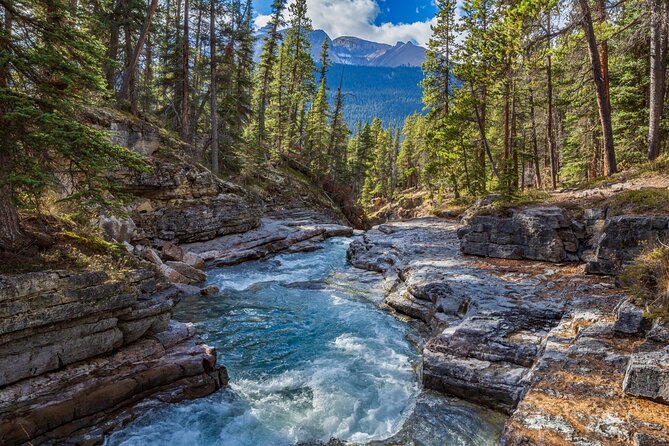
The tour continues past Mount Coleman and the HI Rampart Creek Wilderness Hostel before reaching Saskatchewan River Crossing. The hostel is tied to the growth of outdoor tourism in the region, while Saskatchewan River Crossing connects the modern road with older ways of crossing the river.
The narration describes an 1882 operation run by John Walter, who used a floating plank to move a horse and carriage across the water. It is a small story, but it helps you picture how difficult movement through the Rockies once was.
At Howse River, turn into the parking area for Howse Pass Viewpoint. The stop has views of the river and surrounding mountains. Mistaya Canyon comes next, with a moderate 1.5-mile trail taking about 40 minutes to reach the gorge.
Mount Chephren rises 10,715 feet and has angular slopes that once led to the name Pyramid Mountain. Since another summit already had that name, it was renamed for an Egyptian pharaoh associated with the second-largest pyramid at Giza.
Waterfowl Lake is visible close to the road, making it one of the easiest stops for a quick photo. The narration also connects the area to the counterculture movement of the 1960s. Mount Patterson and Snowbird Glacier follow, with the ice flowing down the mountain in a shape that can resemble outstretched wings.
Peyto Lake, Bow Lake, and Lake Louise
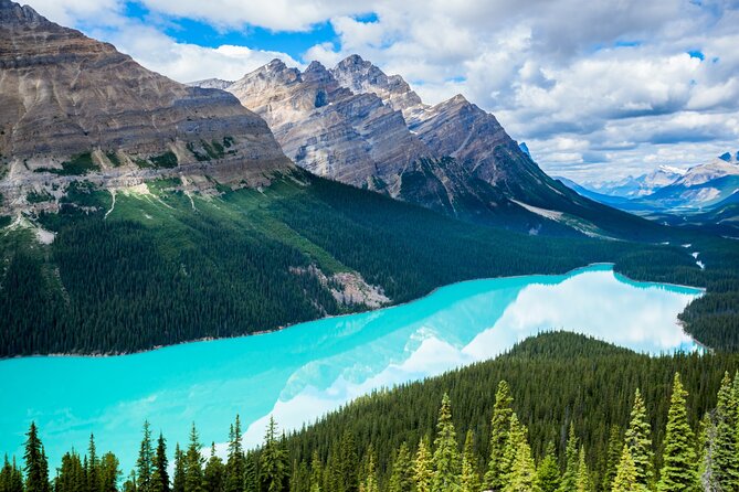
Peyto Lake is one of the route’s famous turquoise-water stops. A side road leads to an overlook and a roughly two-mile trail around the lake. The audio explains the connection between glacial water and the bright color, helping you understand why so many lakes along this drive look almost unreal.
Bow Lake reflects Mount Jimmy Simpson and its surrounding peaks. The mountain is named for an English immigrant, another example of how the route mixes physical geography with human stories.
Crowfoot Glacier has lost one of its three ice lobes over time. The remaining shape no longer matches the full crow’s-foot form that gave the glacier its name, but the viewpoint still offers a strong look at how quickly glacial features can change.
The Wapta Icefield follows, along with Hector Lake beneath Lilliput Mountain and Mount Balfour. Hector Lake is a particularly good photography stop because the water sits directly below these high peaks.
At the end of the Jasper version, continue toward Lake Louise for another five to ten minutes. If you are using the tour in the opposite direction, start with the Lake Louise version and follow the app toward Jasper.
Is $16.99 good value?
For one carload of up to four people, the price is hard to criticize. A group pays $4.25 per person at full capacity, and the tour can be reused on any trip because access does not expire. You can also pause it, restart it, skip stories, and use it across multiple days.
The value is strongest if you are driving independently and want context without paying for a private guide or joining a fixed bus schedule. It is also useful for a mixed group. One person may want every waterfall, while another wants only the major viewpoints. The app lets you adjust the day.
The price does not cover attraction admissions, reservations, the Skywalk, or any other paid activity along the route. It also does not replace a park pass or solve the basic costs of renting a car and spending a day on the road.
Setup tips that can save your morning
Download the app and tour while you still have reliable service. Enter the password from your email or text message, then test the audio before you leave.
Use Bluetooth, USB, or AUX to connect the phone to the car stereo. Apple CarPlay is supported for audio playback. Android Auto support is described as forthcoming, so do not rely on it if your vehicle uses Android Auto.
If the app does not launch on the first attempt, do not wait until you are deep into the parkway to troubleshoot. The setup process can feel more complicated than simply tapping a link. Keep the itinerary available as a backup, and remember that the tour can be started from a designated point in the selected route.
The recommended devices are an iPhone with iOS 15 or later, an Android device with version 9 or later, or an iPad or tablet with GPS and cellular capability.
Who should book this audio tour?
I would choose it for a couple, family, or small group already planning to drive the Icefields Parkway. It suits people who like history and geography but do not want a guide controlling every stop. It is also a good fit if you want to make the day shorter or longer depending on weather, energy, and road conditions.
It may not suit you if you want personal conversation, live answers, music between stories, or a fully planned sightseeing schedule. You also need to be comfortable handling the app before the drive begins.
Cancellation is free when you cancel at least 24 hours before the start time. Within 24 hours, the payment is not refunded.
FAQ
How long does the Icefields Parkway audio tour take?
The drive and narration take about three to four hours. Your day will take longer if you stop for hikes, photos, meals, viewpoints, or paid attractions.
Where does the tour begin?
The supplied tour version begins in Jasper and continues toward Lake Louise. A separate version begins near Lake Louise and runs in the opposite direction, so select the correct starting point in the app.
How many people can use one purchase?
One purchase covers a group of up to four people in one car.
Does the tour work without cell service?
Yes. You must download the tour while you have strong Wi-Fi or cellular service. After downloading, the audio and maps work offline.
Is the narration available in English?
Yes. English is the available language.
Does anyone meet me at the starting point?
No. This is a private, self-guided activity. You go to the starting point, open the Action’s Tour Guide app, and follow the GPS-triggered stories.
Are attraction tickets included?
No. Attraction passes, entry tickets, and reservations are not included. This includes activities such as the Columbia Icefield Skywalk.
Does the tour expire?
No. The tour includes lifetime access with no expiry. You can use it on multiple trips and pause or restart it as needed.
What happens if I need to cancel?
You receive a full refund if you cancel at least 24 hours before the scheduled start time. Cancellations made within 24 hours are not refunded.
Should you book it?
Book this tour if you want the freedom of a private car with the useful context of a guide. The narration gives purpose to the long drive, points out dozens of stops, and helps you choose between a quick viewpoint and a longer hike. At $16.99 per car, it is especially good value for two to four people.
Skip it if app setup frustrates you or if you want a live guide and a fixed itinerary. Download everything early, confirm Jasper or Lake Louise as your starting direction, and treat the three to four hour estimate as driving time rather than a full sightseeing schedule. Done that way, this is a practical companion for one of Canada’s great mountain roads.
Latest audio tours in Canada
- Fruit alcohol tasting + Velvet Orchards audio tour★ 5.0 · 2 reviews
- Quebec City Self-Guided Driving Audio Tour★ 4.0 · 7 reviews
- APP Self-Guided Tours Quebec with Audioguide★ 3.0 · 2 reviews
- Layers of Natural History: Picton Nature Self-Guided Audio Tour★ 5.0 · 4 reviews
- Smartphone Audio Driving Tour between Wasaga Beach and Toronto★ 4.5 · 3 reviews
- Niagara: Behind The Falls, Skylon Tower Ticket & Tesla Audio Tour★ 3.5 · 69 reviews
- Niagara Falls Pass: 5 Iconic Attractions, WEGO Bus & Audio Guide★ 5.0 · 7 reviews
- Niagara Peninsula: a Smartphone Audio Driving Tour★ 4.0 · 10 reviews
Driving Audio Tours, compared.


Ultimate Acadia National Park Self-Guided Driving Audio Tour
Read our review →


Browse the lists this tour appears in