
Reviewed · USA
Michigan Lakeshore, M-22 Self-guided Driving Audio Tour
Michigan’s M-22 is more than a pretty road. It threads together Lake Michigan beaches, old fishing towns, coastal marshes, working harbors, lighthouses, and Sleeping Bear Dunes. This self-guided audio tour gives the drive a useful sense of place, explaining why the shoreline looks as it does and how timber, shipping, fishing, and Native communities shaped it.
I like two things right away: you pay $14.99 per car group of up to four, and the stories play automatically as you drive. You also get offline maps, so a weak signal need not spoil the route. The main caution is that the audio does not replace planning. Some stops close seasonally or during government shutdowns, and one user wished the route appeared more directly on GPS.
Key points to know before you go

- More than 121 miles of shoreline driving: The route runs from the Frankfort area through Sleeping Bear Dunes, Leland, Northport, Suttons Bay, and Traverse City.
- Over 78 location-triggered stories: The narration covers geology, lumber, shipwreck-era commerce, Native history, lighthouses, towns, and outdoor stops.
- Best value for a full car: At $14.99 for up to four people, the cost is far lower than a private guide or group excursion.
- Plan on a full day: The advertised trip takes about 8 to 9 hours, while the core audio route is described as taking 2 to 4 hours without long stops.
- Bring time for side trips: Arcadia Marsh, Green Point Dunes, Point Betsie, the Dune Climb, Pyramid Point, and Fishtown all deserve more than a quick look.
- Download before leaving strong service: The app works offline only after the tour has been downloaded to your phone.
What the M-22 audio tour actually gives you
This is a private driving experience, not a bus tour and not a scheduled walk. No guide meets you at Frankfort. Instead, you download the Action Tour Guide app, enter the password sent by email and text, drive to the starting point, and let GPS trigger each story.
That format suits M-22 well. You can stop for a photo, pause the narration for lunch, skip a point that does not interest you, or spread the route across several days. The access is advertised as lifetime, with no expiry, so the tour can also work as a planning tool before your trip and a repeat guide on a later visit.
The audio covers more than directions. At Great Lakes Bay, it begins with the size and character of the Great Lakes, which hold 21 percent of the world’s surface freshwater. At Portage Lake, the story turns to lumber mills and the timber economy that sent processed wood across the lakes.
That context matters. Without it, the route can seem like a chain of beaches and small towns. With it, you begin to see why waterways, forests, sandbars, and harbors determined where communities grew.
Connect your phone to the car by Bluetooth, USB, or AUX. Apple CarPlay is supported for audio playback. Android Auto support is listed as coming soon. An iPhone with iOS 15 or later, an Android phone with version 9 or later, or a GPS-equipped cellular iPad or tablet is recommended.
More Self-Guided Audio Tours in the USA
- Gettysburg Battlefield Self-Guided Driving Audio Tour
★ 4.5 · 910 reviews - Joshua Tree National Park Self-Guided Driving Audio Tour
★ 4.5 · 762 reviews - Ultimate Acadia National Park Self-Guided Driving Audio Tour
★ 4.0 · 521 reviews
Frankfort, Portage Lake, and Arcadia Marsh
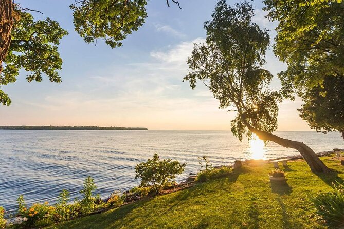
The early section sets the pattern for the day. You travel beside Lake Michigan, hear about the state’s familiar mitten-shaped map, and learn why this western edge of Michigan’s Lower Peninsula developed around timber and shipping.
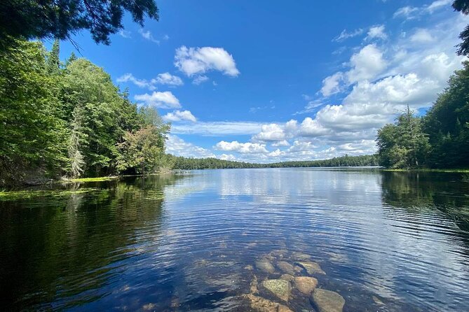
Portage Lake is a good early story stop because it connects scenery with industry. In the mid-1800s, sawmills appeared along the coast, turning nearby forests into lumber that could be shipped to larger cities. The audio also explains a mill connected with the lake, giving the quiet water a working past.
Arcadia Marsh Nature Preserve is one of the route’s more useful nature stops. It is one of only 15 remaining coastal marshes along the Lower Peninsula shore of Lake Michigan. A dry, raised boardwalk lets you cross the marsh without a difficult trail.
Allow about 30 minutes here if you want more than a roadside glance. Bird, butterfly, and plant enthusiasts will get the most from the stop. Dogs are not allowed, and the turn can be easy to miss, so listen closely for the directions.
Crystal Lake adds a geological chapter. It was once a bay connected to Lake Michigan, until sand dunes closed it off about 2,000 years ago. The audio also tells the story of Archibald Jones and his attempt to reopen a water connection through the Benzie County River Improvement Company.
You may also pass Crystal Lake Alpacas. The supplied stop information gives this point a short 15-minute window, so treat it as a brief roadside feature rather than a major scheduled visit.
Green Point Dunes and Frankfort’s lakefront
Green Point Dunes offers a real walk instead of a quick photo stop. The route includes a roughly two-mile hike through shaded woods to a sandy Lake Michigan beach. Wooden stairs lead down to the shore.
That distance and the stairs change the day’s rhythm. Wear shoes you can walk in, and do not count this as a five-minute stop. The audio lists only about 10 minutes at the point, but that is better understood as a prompt to stop, not enough time to complete the hike.
Frankfort Beach is easier to reach. Continue along Forest Avenue to the water, where a small parking area serves the public beach. The pier and Frankfort lighthouse add a clear visual marker, and the sandy shore makes this a sensible place for a break.
I like the way the tour lets you decide how much time to give each place. You can make Frankfort a quick look or linger by the water before continuing. Just remember that a full route with beaches, hikes, and town stops will run much longer than the audio itself.
Point Betsie and the approach to Sleeping Bear Dunes

Point Betsie Lighthouse is one of the route’s headline stops. It is among Michigan’s most photographed lighthouses and sits beside a broad sandy beach. You can walk the grounds, while guided tours operate from Memorial Day weekend through late October for a small fee.
The timing matters. The drive itself does not include admission to attractions, tour tickets, or reservations. If you want to go inside a lighthouse or visit a paid site, check its current schedule before setting out.
Sleeping Bear Dunes National Lakeshore is the major natural prize of the route. The audio introduces the park before arrival, which helps you choose how much time to set aside. You could pass through quickly, but that would miss much of what makes the M-22 drive worthwhile.
Old Indian Trail gives hikers a quieter option. It has two loops of about 2.5 miles each and follows part of a route used by early Native Americans between a camp and fishing sites. The stop suits you if you want a walk with less focus on the park’s most famous viewpoints.
Start at the Philip A. Hart Visitor Center if you want orientation before exploring the park. The directions point you toward West Front Street and a bluish building with park signs. This is a smart place to gather information and get a clearer plan for the Dune Climb, trails, and beaches.
More Driving Audio Tours in the USA
- Ultimate Lake Tahoe Self-Guided Driving Audio Tour
★ 4.5 · 435 reviews - Scenic Newport, RI Self-Guided Driving Audio Tour
★ 4.5 · 325 reviews - Arches National Park Self-Guided Driving Audio Tour
★ 4.5 · 288 reviews - Yellowstone National Park Self-Guided Driving Audio Tour
★ 4.5 · 249 reviews
The Dune Climb, Alligator Hill, and Glen Arbor
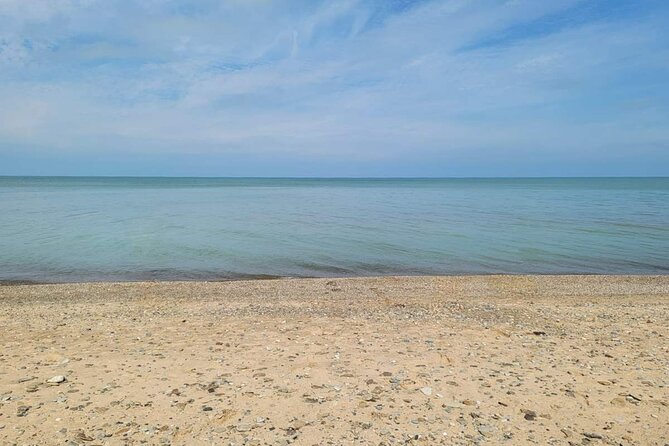
The Dune Climb is one of Sleeping Bear Dunes’ best-known stops. The climb rises nearly 300 feet, and it is one of the few places in the park where climbing the dunes is encouraged. Parking is available, and the sand rise is hard to miss.
This is not a casual flat stroll. The steep climb can take more energy than the short drive from one stop to the next, so give yourself time and water. The tour’s roughly 30-minute suggestion is a useful minimum, not a promise that you will reach the top, rest, and return without lingering.
Alligator Hill offers another kind of walk. The route leads uphill toward Islands Lookout, with a roughly three-mile round trip to the viewpoint. On a clear day, you can see toward the Manitou Islands.
Glen Arbor is a good place to stop for food, art, wine, or cider. The town has galleries, tasting rooms, and cafes, and it can serve as an overnight base if you do not want to complete the whole route in one day. The audio gives Glen Arbor about 20 minutes, but this is one of the places where you may sensibly ignore the clock.
Manitou Islands, Pyramid Point, and Good Harbor Bay

The Manitou Islands receive several mentions because they are central to the character of Sleeping Bear Dunes. North Manitou and South Manitou are part of the national lakeshore and are largely uninhabited. The narration gives you enough background to understand their place offshore, even if you do not take a boat trip to them.
Pyramid Point is one of the strongest viewpoint stops. The trail is about three miles from the trailhead and leads to a broad view over Lake Michigan. The route also points you toward Port Oneida Beach, giving you a choice between a hike and a shoreline stop.
Good Harbor Beach is better for a slower pause. You can walk, swim, or watch the sunset, but there are no lifeguards. Waves and rip currents are a real concern, so use care in the water.
The audio also explains the Manitou Passage, the waterway between the islands and the mainland. In the 1800s and early 1900s, ships moved goods through these waters. That story adds a practical reason for the many lighthouses and harbor settlements along this shore.
Leland’s Fishtown and the Leelanau Peninsula
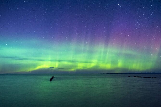
The route shifts from dunes and trails to the Leelanau Peninsula. Its name came from Henry Schoolcraft, a federal Indian agent in the 1820s, and his wife, Jane Johnston. The story connects the place name with the area’s Native and governmental past.
Leland’s Historic Fishtown is one of the most distinctive town stops. The community grew near the Leland River, where the water reaches Lake Michigan and creates a natural fishing area. The site also rests on the location of one of the oldest Ottawa villages in the Great Lakes region.
This is a place where you should get out of the car. The old fishing setting gives the tour a more human scale after the open dunes and beaches. Allow extra time if you want to stroll rather than simply hear the story while passing through.
The audio then reaches Beaver Island, the largest island in Lake Michigan. Its history includes a period as a self-proclaimed theocratic monarchy, an unusual detail that gives the island a memorable place in the route’s storytelling.
Northport, the lighthouse, and Grand Traverse Bay

Northport sits on Grand Traverse Bay and was settled in the mid-1800s. The narration links its growth to a smallpox epidemic that helped scatter settlers across the state. It is a reminder that town development did not always follow a neat plan.
The Grand Traverse Lighthouse Museum offers another stop where operating dates matter. The story of lighthouse keeper Philo Beers, who took over after David Moon left after only about eight months, gives you a glimpse of how demanding lighthouse work could be.
Peshawbestown lies within part of the Grand Traverse Indian Reservation. The audio explains its connection to Odawa communities and to an earlier settlement called Eagle Town. The name Peshawbestown honors Chief Peshaba.
Suttons Bay was once known as Suttonsburg and served as a fueling stop for steamships. Ships loaded cordwood there to fire their boilers. These details make the bay feel less like a quiet holiday town and more like a working part of Great Lakes transportation.
Traverse City and the final museum stop
Traverse City sits at the head of the east and west arms of Grand Traverse Bay. It is the natural endpoint for the route and a sensible place to stay for several days if you want to explore Sleeping Bear Dunes and the Leelanau Peninsula at a slower pace.
The Dennos Museum Center is the final listed stop. Its rotating exhibits have included artists such as Dale Chihuly, Mathias J. Alten, Orna Ben-Ami, and Andy Warhol, along with the traveling Bodies Human exhibition. Since temporary displays change, check what is showing before you plan your final stop around the museum.
The route ends in a different location from its Frankfort start, so this is not a loop. That matters when arranging lodging, rental cars, or a return drive. The route is best for a point-to-point road trip, not for someone who needs to finish at the starting location.
Price, timing, and the practical tradeoffs
At $14.99 per group of up to four, this is excellent value if you are already driving the route. A couple pays the same as a family of four, and the cost is modest compared with a scheduled guided excursion.
The price does not cover entrance fees, reservations, or attraction tickets. It also does not include a person who can adjust the route for weather, closures, or your personal interests. You get narration and navigation support, not a live guide.
The full experience is advertised at 8 to 9 hours. The core audio is also described as taking about 2 to 4 hours, which makes sense if you drive steadily and skip most hikes. Give yourself a full day if you want beaches, lighthouses, the Dune Climb, Fishtown, and a museum.
Download everything while you have strong Wi-Fi or cellular service. Search your email and text messages for audio tour to find the setup instructions and password. The app needs to be installed separately from any booking app.
One practical weakness is route visibility. The audio triggers by location, but the experience is not described as a standard turn-by-turn GPS tour. Follow the route, obey speed limits, and keep navigation available if you need more direct map guidance.
Seasonal access also deserves attention. Some locations may be closed outside their operating season, and a government shutdown can affect park facilities. The product information says lifetime, no-expiry access, while a provider response refers to a one-year validity period. Confirm the current access term before booking if that detail matters to you.
Who should book this M-22 drive?
I would choose it for a couple, family, or small group that wants freedom rather than a fixed schedule. It works especially well if you enjoy hearing the story behind a place but do not want someone in the car all day.
It suits independent drivers, repeat visitors, and anyone willing to pause the audio and explore. Hikers should like the stops at Green Point Dunes, Old Indian Trail, Alligator Hill, and Pyramid Point. History fans get lumber, shipping, Native communities, fishing, and lighthouse stories.
I would think twice if you want a live guide, a tightly managed itinerary, or a simple loop from Frankfort. The app also depends on your phone, GPS, and correct setup. Downloading ahead of time is essential.
Should you book it?
Book this tour if you want a low-cost way to give a long scenic drive some structure. Its strongest feature is not simply the narration. It is the freedom to combine short audio stories with your own choices: stop at Arcadia Marsh, climb a dune, linger in Leland, or pause for sunset at Good Harbor Beach.
Skip it if you prefer to discover every stop without prompts or if you need live help with navigation. For most independent drivers, though, the $14.99 group price is easy to justify, especially when you treat the route as a full-day or multiday guide rather than a quick drive-through.
FAQ
Where does the Michigan Lakeshore M-22 tour start?
The tour starts in the Frankfort area at the first story point. No guide meets you there, so you must open the Action Tour Guide app and go to the starting point yourself.
Where does the tour end?
The listed route ends in a different location, with Traverse City and the Dennos Museum Center as the final listed stop. It is a point-to-point drive rather than a loop.
How long does the tour take?
Plan on about 8 to 9 hours for the full experience. The core audio route is described as taking about 2 to 4 hours if you do not spend much time at the stops.
How much does the tour cost?
The price is $14.99 per group of up to four people. You purchase one tour for the car group rather than paying separately for each person.
Is the tour available in languages other than English?
No. The tour is offered in English.
Does the price include attraction admission?
No. Attraction passes, entrance tickets, and reservations are not included.
Do I need cellular service during the drive?
You need strong Wi-Fi or cellular service to download the tour before starting. After downloading, the app and maps work offline.
How does the audio start?
Enter the first story’s location and open the Action Tour Guide app. The audio begins automatically when you reach the location, and later stories play as you follow the route.
Can I pause the tour or complete it over more than one day?
Yes. You can start, pause, and resume the tour whenever you like, take breaks, skip stops, and use it over multiple days.
Are hikes and beaches included in the tour price?
The audio directs you to places such as Green Point Dunes, Frankfort Beach, Pyramid Point, and Good Harbor Beach, but the price does not include admission, reservations, or other attraction costs.
Latest audio tours in the USA
- Sequoia National Park Self-Guided Audio Tour★ 4.5 · 9 reviews
- Sequoia and Kings Canyon Audio Tour Self Guide National Park Tour★ 5.0 · 3 reviews
- Kings Canyon National Park Self-Guided Audio Tour★ 4.0 · 4 reviews
- Sedona, Arizona Self-Guided Audio Tour★ 4.0 · 36 reviews
- Sedona & Red Rock State Park Self-Guided Driving Audio Tour★ 3.0 · 30 reviews
- Haunted Savannah Self-Guided Walking Audio Tour★ 4.5 · 3 reviews
- Downtown Seattle Self-Guided Walking Audio Tour★ 4.5 · 6 reviews
- Uncover Seattle: Self-Guided Audio Tour★ 3.5 · 7 reviews
Driving Audio Tours, compared.


Ultimate Acadia National Park Self-Guided Driving Audio Tour
Read our review →


Browse the lists this tour appears in